body{background-attachment: fixed ! important; }
Showing posts with label Guoxing. Show all posts

Monday, August 21, 2017

Back Roads: Taichung Route 97

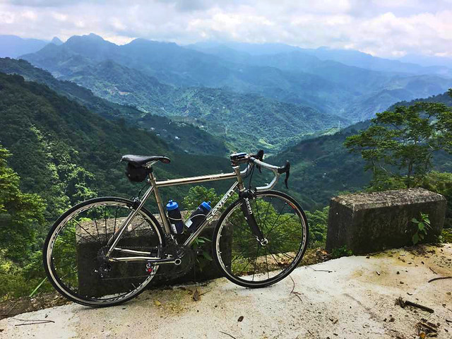
19399282_10154831546122972_4429269981895258003_n

It isn't always about how you start, but rather, how you finish. And that was the message of the day when we started out on the regular loop from Taichung to Guoxing and back.

The planned route was set for the Highway 21 and back on the not so difficult return along the Highway 3 through Wufeng Township. That was the plan.

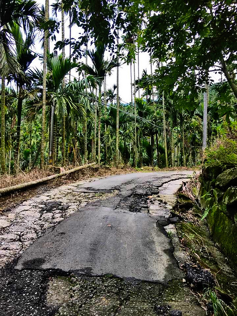
Instead, somewhere in conversation I got on the topic of the little used Route 97, which is little used for good reason. It is the old road from Dongshih to Guoxing before the Highway 21 was completed and has fallen into a state of disrepair on the Nantou side.

Naturally, we decided to roll the dice and see if conditions had improved.
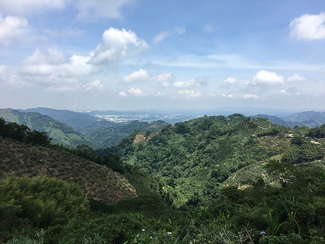
IMG_7737

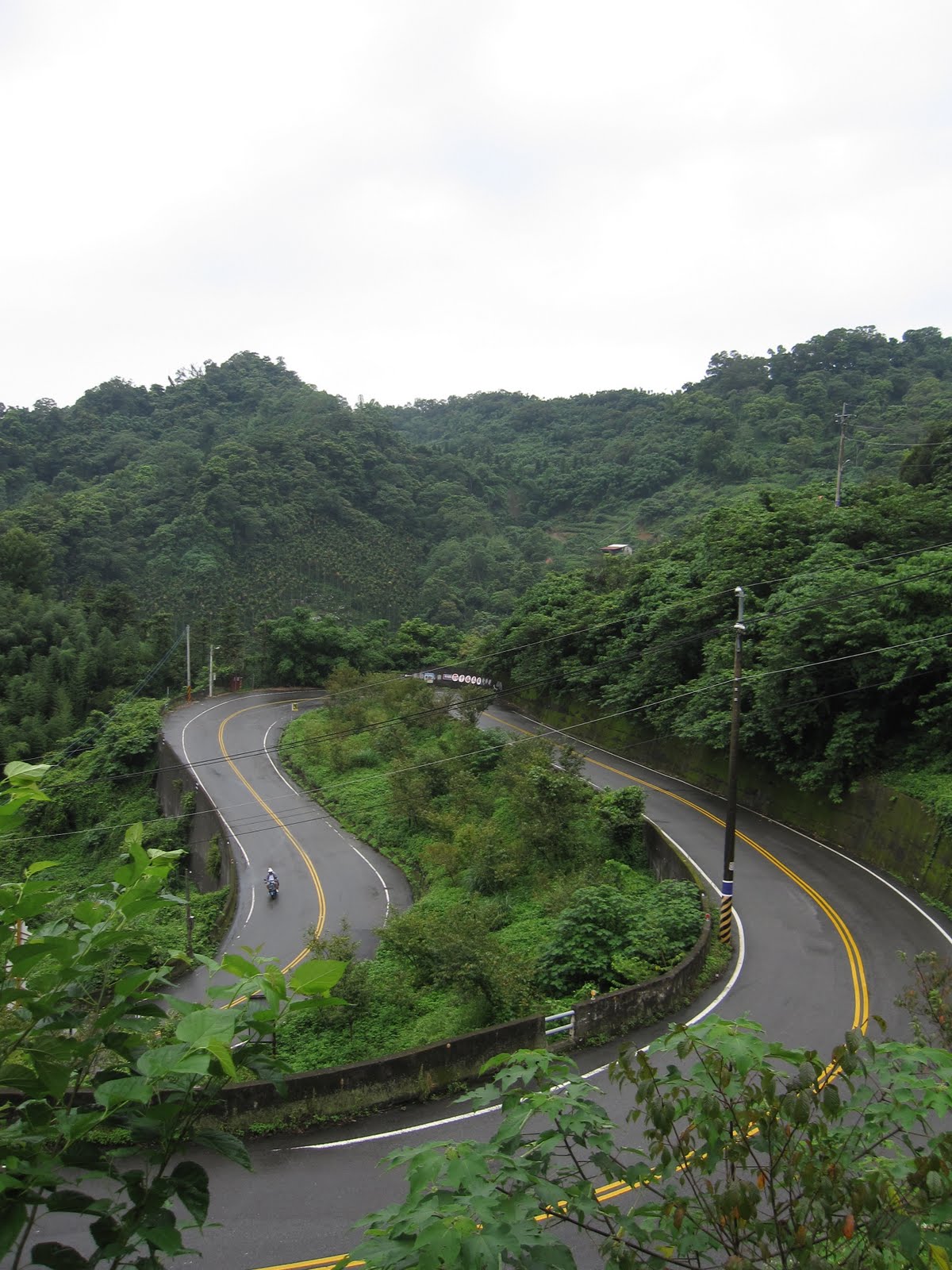
The initial ramps of the Route 97 start on the lower reaches of the Highway 21. There is a small sign to warn motor vehicles that it is not a through route, but other than that it just looks like a stretch of pavement that gets swallowed by the mountain.
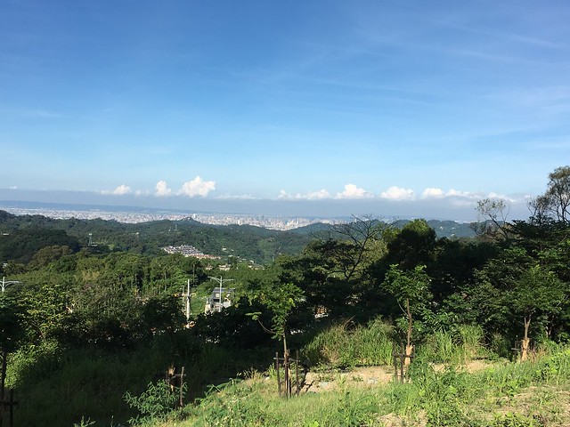
IMG_7716

I hadn't been up the Route 97 in some time, and each time was in less than clear weather. The roads in parts were simply areas of chunky concrete with generous helpings of mud.

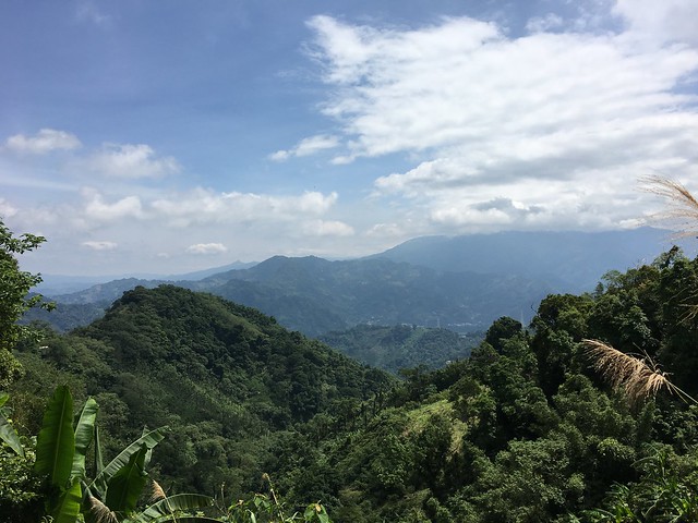
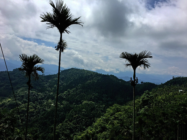
Today the views were stunning.
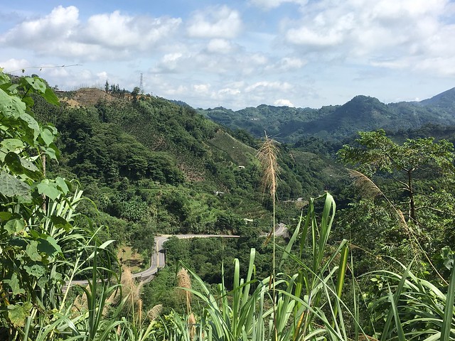
IMG_7717

The climb is quite a bit steeper than the Highway 21, with nary a human sound to interrupt the sound of your own labored breathing. The overgrown jungle along the road offers a bath of shade as consolation for the sustained gradients, and the roadway is still quite smooth.

IMG_7721

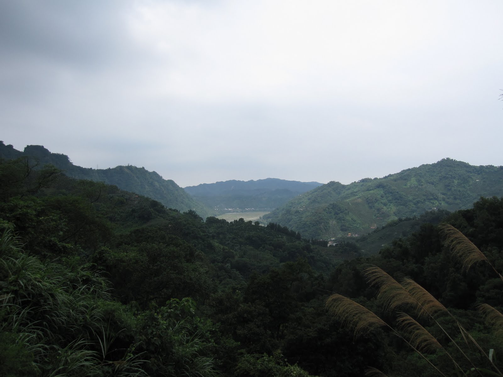
In the breaks between vegetation, the landscape washes over pockets of white buildings in the distance and reveals a green oasis over the dust of Taichung and its far flung townships.
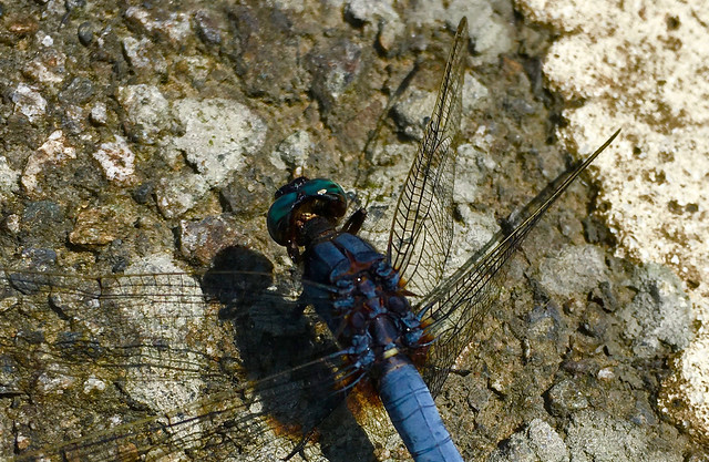
IMG_7722 Bug IMG_7735

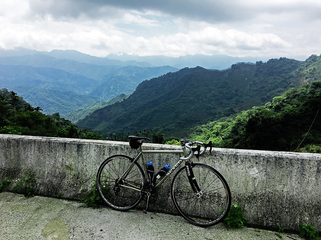
The summit sits about 320m above the Highway 21, which can be spotted between the trees below. The foothills of Taichung push up against the Central Mountain Range in the distance and make for fantastic views.
IMG_7739 19399312_10154831546212972_1781839004042296878_n

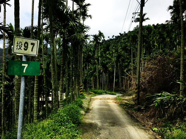
The descent was better this time around, but it is not easy. There are several technical sections and it can be very easy to take the wrong road. The single lane rips through sparse farms in betel nut country for an exciting downhill filled with excitement before cleaning up for a reintroduction to civilization in Guixing.

This is by no means the regular route to Guoxing... but if you trust your equipment and your cycling skills, it makes for a little variation on an otherwise routine route.
19399383_10154831546277972_9218981559161374120_n

Wednesday, April 4, 2012

KOM: Learning Taichung's Best Climbs


With a beautiful gap day mid-week for the Taiwanese Tomb Sweeping holiday, when families head out to the graves of their ancestors to clean them up and preserve the Feng-shui to provide better luck and prosperity for the entire family, a few of us decided to use the day-off to hit the hills around Taichung.


I thought I would use the occasion to treat Chris, a cycling neophyte, to the... ahem...joys of climbing over the fence.

We were joined part of the way by Michael Turton, who was tired from a weekend of heavy riding and only stayed until Dong Shih before swinging back to Tanzi.

In Taichung, "The Fence" is a term often used to describe the rugged foothills that separate Taichung from Nantou County and the Puli Basin. It is also regarded and a training ground for climbers ranging from weekend amateurs to local Pro-Tour favorites.


The Route 129 on Dongshan Rd.(東山路) leads up to the Hsin She (新社) plateau and provides the warm-up climb. It consists of a series of switchbacks that climb like stairs up Zhong Xing Cliff (中興嶺).

This was really a perfect test day for me as I could see how my knee feels while climbing and I could then back off and take periodic stretches.

For Chris this would be an initiation rite.


We made the Hsin She plateau and then polished up on cornering skills diving into the bends of Zhong-he Village (中和村).

The second climb over Baimao Shan (白毛山) is such a bitchin' road. It combines wide, smooth roadways that mix steady grades with graceful arcs of flat recovery space, before squiggling through fruit orchards to the shady peak.

The road then plummets downward in a phantasmagoric descent of tight hairpins that nearly fold on top of each other.

The bike felt perfectly balanced, so I threw myself into the corners. The centrifugal force at the zenith of each arc, opposed only by the rubberized grip of my Contis against the newly laid asphalt, gave the sensation of surfing the rising swell of a wave. Incredible!


Chris heaved himself over the hill and we stopped for a stretch and a sugar boost at the bottom before returning over the Route 136.


From the Puli side the renown of the 136 is for the final third of the climb. It starts out with gentle rollers between 2% and 4%, but then, just as you cross one of the bridges, the road lets you know who's boss.


I danced on my pedals to recover before mashing through the steeper ramps. Because I knew the route, I was mentally prepared for the challenge. I am at about 70% of my pre-injury fitness, so I was not going to set any records. For Chris, it was his first look at this beast and I left him to write his own manual on how to best overcome.


Most of us, at some time or another, have gone a hill too far.


We know the feeling in the legs of blood vessels popping from the calves. We know the fear of the bonk and the worry of having to hike the bike to the top. We fear the fluttering quake of a cramp in the back of the calf or the lower quad, that only fully presents itself as soon as we give up and try to dismount... then fall over to the folly of everyone or no one watching. We have endured the rivers of sweat that fill our eyewear and slosh burning puddles of brine into our eye sockets. We know the burning in the chest.

The 500 meters of 17% grade along the back side of the 136 is this torture. It is a beast. It is an insult against your mother. It is pure hell.

So we do it for fun.


I waited with sick anticipation for Chris at the shack above the steepest section of the climb. As the gap in time grew, I knew that Chris was busy getting his education on the ramps below.


Finally, Chris came storming around the corner in a flurry of motion and sound. He was not going to be defeated by the 136. I joined him and we capped the 136 all a bit worse for wear, but it was over.


After a bit of a breather to bring the color back into his face, Chris could only reflect on his painful, demoralizing climb.... "Fuckin' awesome, dude! I just climbed the 136."

That's what keeps us coming back. To do it and do it again, even better.


I let gravity pull me into Taiping for one last plunge, banking like a sports car through each bend.


We parted in Taiping and I rolled out to meet my wife and daughter at the park, where my little girl took to inspecting the craftsmanship of a fine titanium frame.

Nice ride. Nice day.

My legs feel like they are getting healthy again. When that happens, I don't know what kind of crazy I'll get myself into.

Congratulations Chris, you've entered a strange new world.


Sunday, August 14, 2011

Huisun Leisure Forest Adventure (惠蓀林場): A Trip To Taiwan's Ideal Oasis for Forest Recreation

My Hi Life Fan Club

On Saturday I determined I still needed to put some more altitude into my legs and set my sights for the Huisun Leisure Forest in Nantou's Ren Ai Township.

Tandem

After two consecutive weekends of unstable weather, Taichung's cyclists were out in force and champing at the bit for some saddle time. Riders of all shapes and sizes were on the roadways and making it count.

Team Neko

I tagged along behind Team Neko for a while and it was nice to see so many of their riders assembled in one place.

Rare Cyclist Getting Bent

Along with the different riders on the streets, there were also several different types of bikes.

Rikulau

Although I don't think cycling is all about the gear, it is great to see people's individual expression in their choice of bikes.

Rest Stop

I made casual work of the Route 129 to Hsin She and stopped for a brief coffee at the 7-11, which was already brimming with riders by the time I arrived. The social aspect of Taiwan's cycling scene is something to behold. What I don't get is all the smoking during a water break. I really hadn't been feeling well all morning and feared I may have eaten a "bad peach", which on a long ride, really could have meant being up shit creek without a spare cycling cap.

Clouds Over Hoping

I didn't rest for more than a few minutes to refill before charging out to the Highway 21, where I again saw Glenn from Primavera Cycles out training. I have blogged on this portion ad nauseam, so I won't go into too much detail, but I would like to call out that jerkoff gangster with the Honda Civic in front of me who threw a half-can of Heineken out the window onto the road in front of me. I have a few problems with this guy: a) Don't be drinking and driving at 8:00am on a mountain road b) Don't throw crap onto the road... especially potentially harmful things like containers of liquid... and c) Don't waste good beer.

Follow Highway 21

At Guoxing I hooked along on the Highway 21 through a valley that is just a treat for the eyes. Right where the Highway 21 cuts a tight switchback to Puli, the Chunghua Rd. or Nantou Route 80. shoots off on a one-way trip up into the mountains.


No Catching Fish, No Cooking Fish, No Electrocuting Fish, No Poisoning Fish

The road is marked an official "Bicycle Route" and makes for a nice ride through some pretty towns and various agricultural projects.

Long Haul

Many of the locals are Seediq speakers, but there are several monasteries nearby, so I passed a few monks in grey robes strolling the streets. I realized I had ridden past Qing Chuan Village, which is the location the original inhabitants of Wu She Village were moved to following their violent rebellion against the Japanese administration in 1930.

Aid Station

The Red Cross and Red Crescent sign above is interesting as Taiwan is not allowed to participate in the organization... yet they have so dutifully adhered to the signage.

Geo-Wonders

I paid NT100 to enter the Huisun Leisure Forest and it makes a wonderful first impression. The landscape has been etched by wild rivers and painted by tectonic brushstrokes.


I was soon fighting up the mountain and hugging the cliff walls to avoid debris that might tumble from above. The grades in some parts were over 15% and it made for a good struggle.

Road Going Up

The scenery was that type of wild, high mountain stuff that fills the heart with adventure.

Magnificent!

I mashed my way around one particularly rough bend beneath the shade of tall cedars, when the forest transformed before my eyes into a tame picnic spot for tourists. I was left completely dumbfounded.

Leisure Forest

Here, deep in the forest, there were couples strolling along wide boulevards. There were retirees lounging in one of the dozens of hammocks strung between tree trunks. There were insect sculptures made of logs. There were cabins and teenagers in loud hats mugging for photos. One babbling creek was packed with day trippers cooling their tootsies beneath the rippling waters. It was a "Stepford forest"... almost too idyllic to be real.

My New Friend

There was still a steep set of switchbacks to go, and I made really good time up to the top... and then the road ended at a scenic viewing platform seeded with flowers to attract insects for the bug watchers.

Posing For Pics

I had been expecting more climbing and felt a sense of helplessness when it ended. I thought to myself, "Where do I go from here?" So I turned it into a date with my bike. She and I would enjoy the sights like everyone else.

Frolicking Near The Creek

That lasted all of 10 minutes, when I had had enough and launched back toward home.

Great Road

I stopped for a refill at the Hi Life before heading back home over Route 136 to cap off my day of climbing.

Score:
Distance: 150km (93mi.)
Elevation Gain: 2226m (7306ft.)
Calories Burned: 5000cal.
A Taiwanese National Pastime ?

Saturday, August 6, 2011

Some Days You Get It Wrong: Rainy Day Hill Climbing

Route 95 to Chung Ho Village

All week I had been watching the progress of a nasty looking typhoon out in the Pacific and wondered what it would mean for my weekend riding. I had missed my mid-week rides due to circumstances beyond my control and I really had to get out on the bike.


Based on experience, I figured Saturday would be the better day with the rains coming after the typhoon had passed Taiwan with the majority of the wet stuff falling on Taipei. The Central Weather Bureau and TV news meteorologists tend to have a Taipei-centric view of the weather, so it is easy to disregard their predictions. I also figured that if it did rain, the rain would fall in the afternoon... after 1:00pm. This seems to be the summer pattern.


So with this in mind I planned an ambitious day of climbing that I could accomplish before noon and be safely on my way back to Taichung if and when the rains hit. It sounded like a great plan and I set my sights on the Hui Sun Forest (惠蓀林場).

Hoping Township

My legs were feeling really good and I made short work of the Route 129 to Hsin She. I thought I would stop at the 7-11 along the Route 93 for breakfast and to stock up on extras for a foray into the mountains.

I spent a little time chatting up some riders from Warehouse 185 and another group of guys who were doing the 136 to 129 loop. They all took off to beat the rain, but quickly returned as no sooner had they left then some fat, juicy raindrops filled the air. It was time for another coffee.


After half and hour it looked like the clouds were rained out and so I made my climb over to the Highway 21. Along the way I passed Glenn from Primavera Cycles hacking his way up the switchbacks out of Chung Hsing Village.

Highway 21

It looked like the weather might hold and I was optimistic, but the wet roads made descents slow. Furthermore, it appears Taiwan offers a big bike license in exchange for a deposit of brain cells. Note to Big Bike Riders: It is probably not a good idea to pass me on a blind corner on wet roads at high speeds. You might not see that blue truck. Dumb!


I didn't really need anything, but I thought I would stop at the Family Mart at the bottom of the descent off Baimao Shan. It would be the last stop before going into the mountains. Then, after a few minutes, the skies opened up again. I waited in the store with a bunch of families from Miaoli who did not think I looked like an American because I am too short. I had to point out that Americans can look like anybody... like the Children of the KMT Central Standing Committee and possibly Ma Ying-jiu. I figured as a bunch of moneyed guys from Miaoli, they would not be amused. The rain stopped and I made full speed for the Route 136.

Sunshine on 99 Peaks

I thought I might stop at the Hi Life at the base for a few moments and assess the weather before heading up the hill. Again, it started raining. As I walked around the store I noticed a group of boys on kid bikes had arrived to buy candy. As they came in, one of them noticed me and exclaimed, "Foreigner!"

I went into my well rehearsed pantomime of confusion in which I crane my neck in every direction as if to get a better look, "Where?!"

I convinced him I was not a "Foreigner" and he seemed satisfied with my answer, enough to tell one of the other boys I was not a foreigner when he asked. Then, as fellow cyclists, we then got down to business of talking bikes.

The boys enthusiastically waved me off as the rain stopped and I seized the opportunity to make time up the Route 136.

Gimme Shelter

For most of the ascent spots of sunshine managed to slip through the clouds to create a steamy warmth on the blacktop. I was feeling great and ate up the 8% grades. I was able to reserve my 27 tooth cog for the ramps and that one bastard of a spot 3/4 of the way up by the little farm. I stopped a couple times to take pictures, but they were not strategic photos, just nice pictures with the sunshine casting odd highlights on the 99 peaks in the distance against a dark curtain of rain. I thought I might make it over the 136 without getting rained on and pushed past the last little shelter before the peak.

If you've ridden a road enough times you become familiar with the points along the way to take shelter in a rain squall... and I had just passed the last one before the exposed stretch along the highest point and the treacherous descent to Toubienkeng.

I had been playing a game of Cat and Mouse all day with the weather and this mouse got caught at the worst possible moment.

Rain on 136


The rains started as a light mist, but soon turned into thick drops that instantly soaked into my socks. I couldn't think of any suitable place to sit out the rain except for the possibility of a temple gate up ahead with the possibility of a roof.


Sure enough, it was just wide enough to stand under and wait out the rain. I paced around taking pictures and wondering how long I would have to wait. I also considered the wet descent down the other side.

I watched one ant save another from a raindrop

After 30 minutes the rain held off long enough to get a start on the descent. I just modulated the brakes, kept the speed down, and avoided any of the paint on the road for a slow yet uneventful descent.

As I rolled into Toubienkeng the rains started again forcing me to take shelter under the aluminum covering of a roadside temple.

The rain didn't last more than 20 minutes and soon I was again making good time back to Taichung City... where the roads were dry and the sun was happily poking through the clouds.

Some days you just get it wrong.

Distance: 100km
Climbing: 5151ft.
Weather: Wet

Praying For Good Weather?