body{background-attachment: fixed ! important; }

Sunday, November 23, 2014

Climbing A Mountain Of Tea: Sanlinxi on Nantou Route 49 and 49-1

Untitled

For my last weekend in my thirties I thought I should do something bold. I had a couple ideas in mind, but I needed to check the weather and see when I could get out of the house.

As soon as I saw the yellow glow of the rising sun reflect off the neighbouring high-rise, I took a gulp and knew where I was going-- I would be heading to Sanlinxi--the hard way.

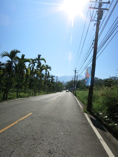
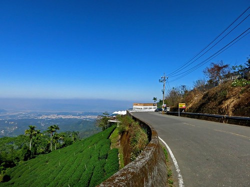
There is the main road to the tea farming district of Sanlinxi, the 151, which snakes its way way past the outdoor tourism megaplex of Sitou and into the thinning mountain air. I have climbed this road a few times and I was looking for something different.

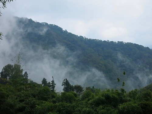
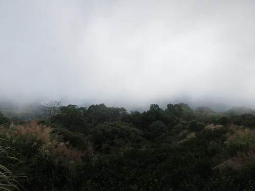
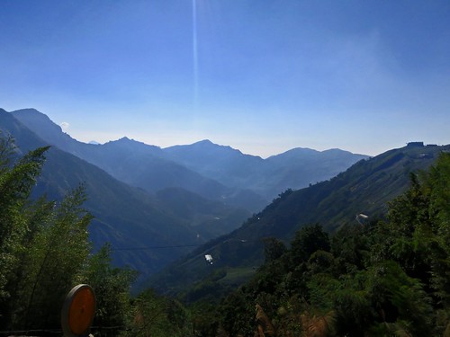
I had only ever descended the Nantou Route 49 and we were constantly being assured that somewhere beyond the towering wall of white mist lay the most amazing panoramic views. This time I was ready for some vistas.

Untitled

I chugged along to Zhushan (Jhushan) in about 90min. and then refuelled at the 7-11 that sits about four blocks inside the Route 149. I took three mini-packs of Gummi Bears to act as my energy gels as hey are cheaper, contain a third more calories than a gel, they taste better and are more fun to eat as they look like little tiny bears.

Untitled

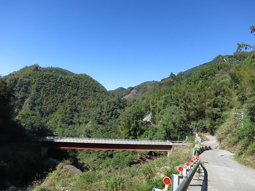
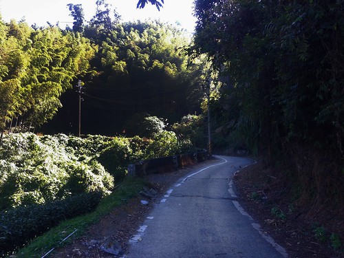
The mountains loomed ahead with the immediacy Taiwan's mountains all seem to possess. The Route  149 makes a quick right and the Route 49 keeps heading straight until it smashed head-on into a cliff that it makes no attempt to circumnavigate.

IMG_2763_2

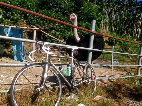
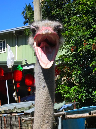
Before any serious climbing could commence, I had to stop at the absurd sight of a large African bird looming over the roadway. It must be the new prestige pet to replace the husky; another inappropriate animal for this environment. The ostrich was not taking visitors andI left before I could see any Moa (Ouch! Sorry about that).

Untitled

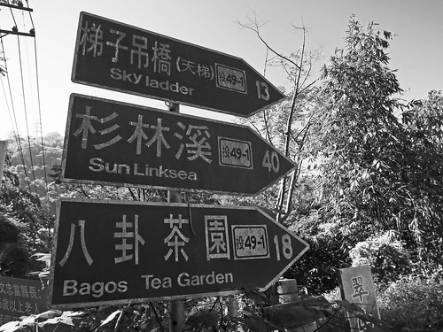
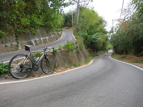
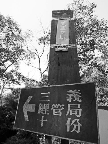
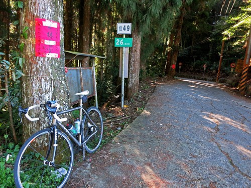
Although I had originally planned to take the 49 all the way up, I was lured into taking the 41-1. With names such as "Sky Ladder", how could I go wrong? It was going to Sanlinxi anyway. Fortunately that distance marker is about twice as far as the true destination.

Untitled

My legs were feeling a bit tired from my Thursday night ride (1650 calories in 90min) and I started to regret not resting another day.

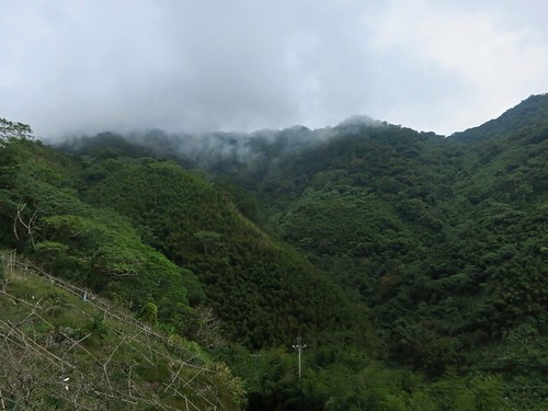
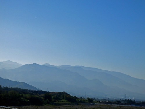
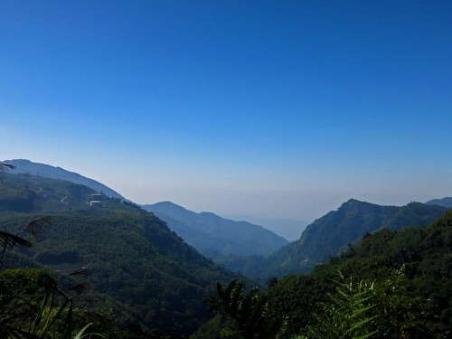
The landscape and my familiar landmarks started to warp into unfamiliar shapes as I edged higher above the plain.

Untitled

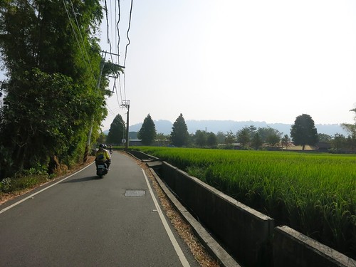
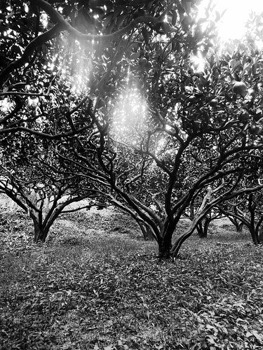
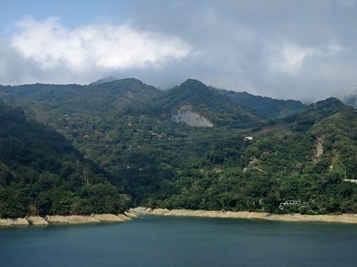
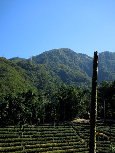
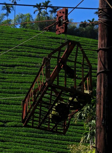
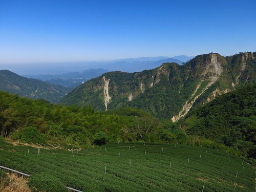
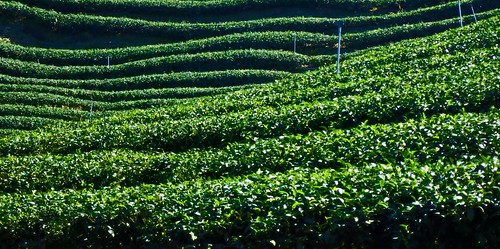
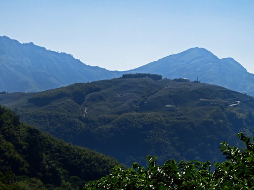
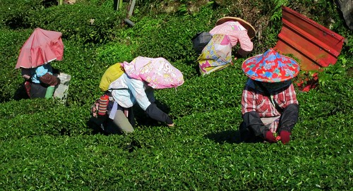
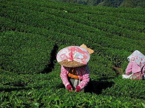
I was smack in the middle of tea country. It is amazing how much tea is being grown, but totally hidden from view.

Untitled

The altitude profile on the Route 49/49-1 is far, far steeper than on the 151. I was forced to battle lengthy stretches at 10 percent or more without the luxury of a switchback or gear spinning shelf. It was just a continual grind that churned my legs into hamburger.

Untitled

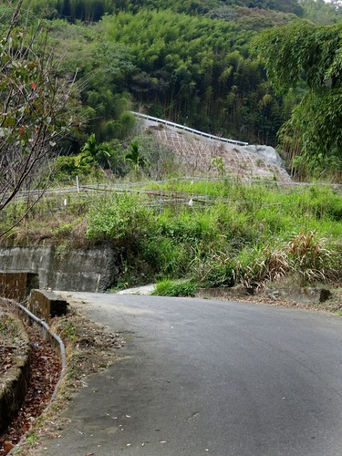
Despite being an alternate route by a good margin, the road conditions on the lower sections were simply praiseworthy.

I found a ridge near the end of the 49-1 to spin the amino acids out on and felt a bit better about my prospects.

Untitled

The 49-1 descended and smacked into the 49. I was sorely disappointed that the "Sky Ladder" has been less spectacular than what I remembered from the Route 49.

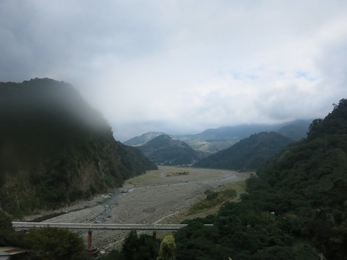
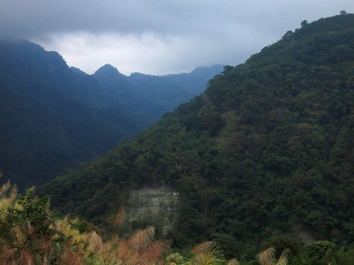
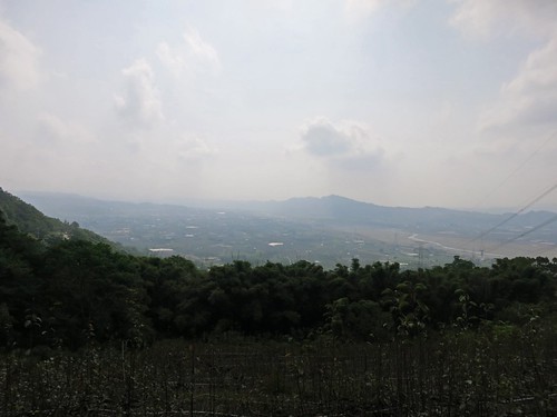
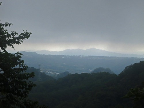
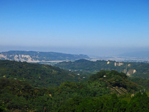
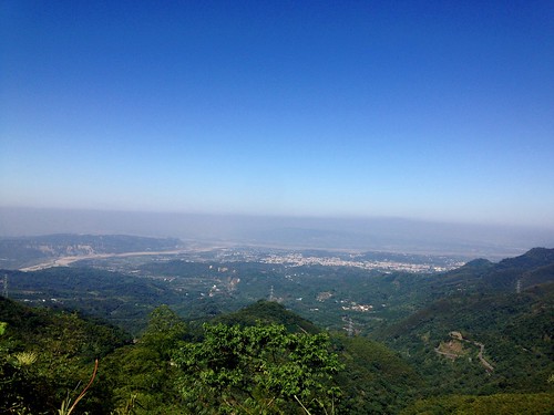
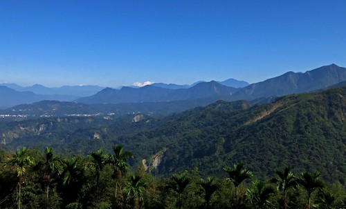
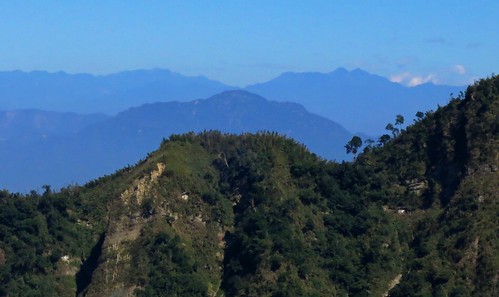
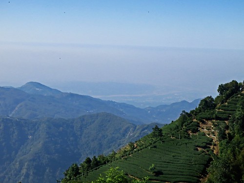
As soon as I turned the corner off the 49-1, the mountains came into view. It is really easy to forget how many of the damned things we have here in Taiwan. Just ripples upon ripples of vertical real estate.

Untitled Untitled Untitled Untitled Untitled

I kept at it and simply enjoyed being almost completely alone out on the roads. I imagine all the KOM contenders took a weekend off from the hills and with the marathon as the sport dejour in Taiwan as marathon chic is cheaper and easier to fudge than cycling chic, there are simply fewer cyclists to be seen in general. The mountains were mine!

Untitled

After a rough dip about three quarters of the way up, the road becomes a narrow minefield of uneven slag. It becomes especially tedious travelling at a slow, climbing pace and takes a lot of attention away from soaking up the views.

Untitled Untitled Untitled

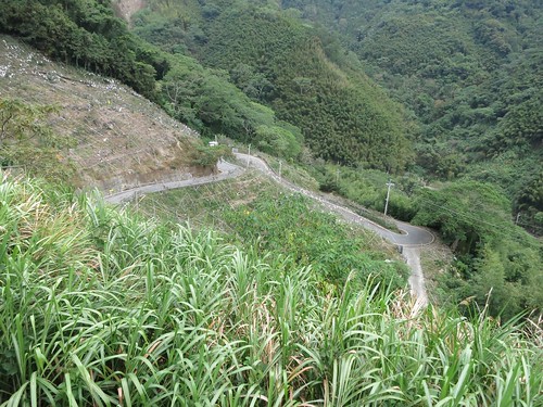
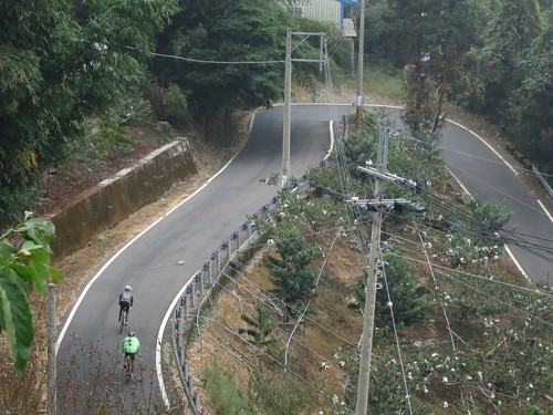
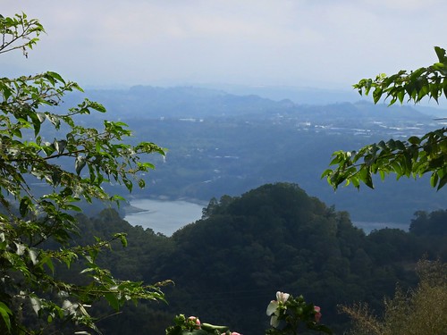
One of the greatest things about the Route 49 is that for large sections it faces outward toward the direction you started the climb. You can look back at your progress and really get a feel for the scope of what you are doing.

Untitled IMG_2781_2

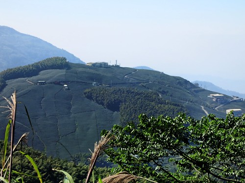
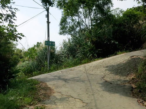
I was well past the point of no-return and found myself a little behind schedule. I was forced to continue upward along a slice of paved track through the tea fields.

Untitled

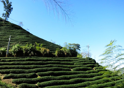
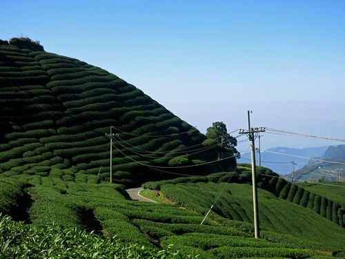
That little ribbon of roadway wrapped itself around every fold and contour on that hillside in a confusing boy scout knot amid layers upon layers of tea.

Untitled Untitled Untitled Untitled Untitled

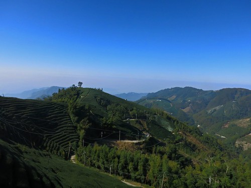
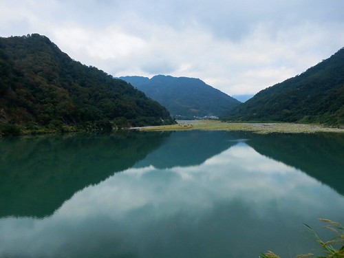
I could look back and still see that I could almost reach out and touch Zhushan, but I was merely elevated above the town by some 2000 meters.

Untitled Untitled

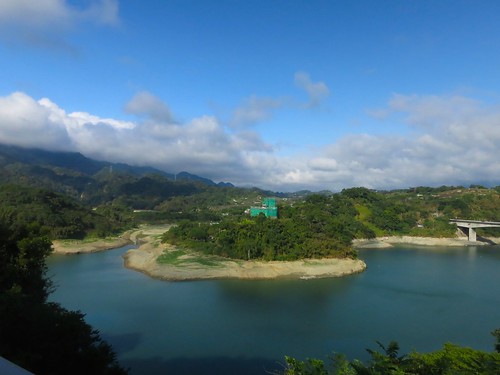
The road finally flattened out and I was able to build up a little bit of speed. I thought I could see the 151 to Sanlinxi just on the opposite hillside.

Untitled

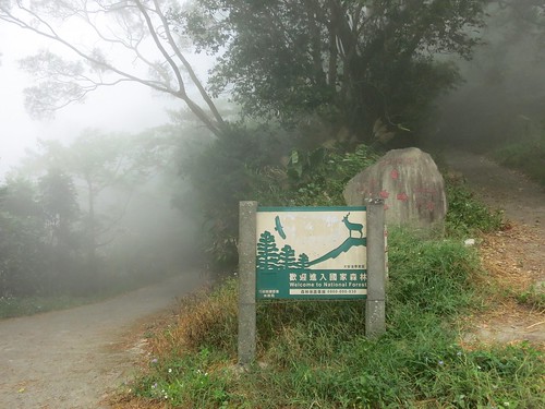
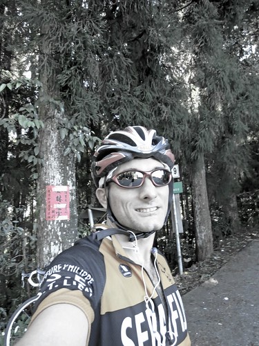
I took one last look over the mountains before disappearing into a cool cedar grove at the end of the Nantou Route 49.

Untitled Untitled

After a celebratory photo, I soaked up the biting chill as I dropped back down into the warmth of the flats.

As I beat it home, I was surprised how fast I was going with a crosswind and a little boost from a slight descent.

I stopped to assist a poor rider who was walking with a flat tire. He had no spare, no pump and didn't know how to change a flat. We have all been there at some point or another in life, and the best you can do is to lend a hand. He was so grateful for the cycling courtesy that we all (hopefully) share.


Untitled

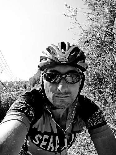
THAT!!! That was a good day on the bike. Rewarding to the last. This is what 5581 calories of hard work looks like.

Route 2,854,053 - powered by www.bikemap.net

Monday, November 17, 2014

Taiwan KOM: King of the Myeloma Fighters

10419451_835350793151779_1528914123209411043_n
What a Poster!

Just a couple days after claiming his second crown in, arguably, the world's toughest climb, Team CCN's John Ebsen is organizing a charity ride to support Multiple Myeloma Cancer research on December 7th. 

You can read up on the heroics and heartbreak amid freezing drizzle high along the slopes of Wuling in Lee Rodger's excellent post as well as in VeloNews. 

This race really has the potential to be the Paris-Roubaix for the world's climbers.

Although this was supposed to be my year for the KOM, I will have to wait until next year to get my suffer on. 

Cheers to all those men and women who had the guts to even roll up to the starting line.   

Sunday, November 16, 2014

Sima Xian Shan: The Alternate Route

Untitled

I started out my morning unsure of where I would be riding. A few factors were in play and with a later start, iffy weather and even less predictable legs, I headed north at a good clip. I felt amazing. I chopped wood all the way to Dongshih and managed to continue at a good clip without leaving the big ring all the way through Dongqi Rd. 

As I crested the hill above the Da-an River, I felt the allure of the road up Sima Xian Shan; a nasty climb between Zhuolan and Dahu. 

A section of the main road was completely wiped out last year, and the word was that passage was impossible. I thought I might see if the situation had improved over the past year, and if not... I would just get a shorter ride and enjoy the afternoon. 

Untitled

I blazed along and caught up with a couple riding road bikes. I stopped to ask if they had any info on a road crossing the mountain. They both thought the road was closed and were just going up the river, only to return the same way. 

I passed another group of riders all kitted out on expensive road bikes. When I hollered to see if they had come over the mountain they stopped and looked at me as if I had my hair on fire. 

Motioning like he might offer me a chocolate bar and a shiny trinket.... "You speak Chinese?"

Of course I had just shouted at him in Chinese, so my answer was a resounding "no" while I asked again in Chinese if they had come from the Dahu side. 

"Where are you going?" one of the guys asked.

" I'm going to Dahu fro this side", I replied. 

"No, you're going the wrong way. You need to turn around. You need to take the Highway 3", he explained. 

" The road past Tian Gou, do you know if it is open?", I asked again. 

*look of confusion*

"You know, the road that goes past Tian Gou down the other side to Dahu... is that road open. I know it was closed this year..." I continued. 

"Dahu.... from here.... but that is climbing....", he said with a perplexed tone. 

I waved them off and found the last police station on the river. 

The cop, told me the 中像道路 was open and goes from Xiangbi Village to Dahu over the mountain. 

Untitled

I was rapidly on my way and eating some serious bitterness on the opening ramps. 

Untitled

It is not as majestic or scenic as the old road, but it offers some spectacular ramps and a few vistas worthy of the effort. 

Untitled Untitled

The Miaoli fog came sweeping in from offstage and the temperatures plummeted. 

Untitled Untitled

I finally met a few riders coming over the hill and we exchanged info on the road conditions each side could expect. 

Untitled

I dropped down some incredible concrete chutes, carful not to pinch flat on the drainage grates that spit the roads every 50 meters.  
Untitled

Suddenly I was spit back out onto the river of the Miaoli 61-- as awesome a road as there has ever been or ever will be. 

Untitled

After a fuel stop in Dahu, I was again plugging back to Taichung at as high a speed as I could will into my legs. 

It is one of those days where the accomplishment is the reward. 

THE ROAD IS OPEN!

Untitled

Route 2,846,529 - powered by www.bikemap.net

Guan Dao Shan: Death Climb In-Sanyi-ty!

Untitled

This time of year is a great time to teach the legs how to climb. With the northern monsoon pushing a steady wind from the north, the hills offer some respite in putting out a strong effort and actually accomplishing something. 

I had been eyeing a road for some time, but I never really had a great opportunity to follow it. I had been down the lower section several times, and each descent I always thought I wouldn't want to try climbing up that very hill. I wouldn't want to try it... until I actually did try it: The Fuxing Agricultural Road. 

Untitled

The ride out of Taichung was a bit of a sleepwalker, with a group of cyclists rolling out for some mass event or another. 

Untitled

I hoped to take a bit of a shortcut through the Houfeng Bike Trail, but it was blocked off by a marathon (the current sport dejure of Taiwan). I had to take a couple farm roads back to the Highway 3. 

Untitled

Eventually I was back up on the Miaoli Route 52-2 along the southern end of the Liyutan Reservoir. This was where the ride really started. 

At the section beneath the dam where the 52-2, Miaoli 49 and 52-3 meet, I launched up the 52-3. Launch it the appropriate word as the road is a single lane of vertical abuse. It is one of those roads where you clip in and then hang about a mile out over the handlebars to keep the front wheel down. 

I bit and spit my way to the top and then, surprisingly, kept going. I did have to dismount once to let a car pass, but I was feeling great. 

Untitled

The road dishes out a few more bumps before settling down high above a shady wetland that completely transforms the mood into something resembling tranquility. 

Untitled

After another long, straight climb, I took a breather to orient myself on the GPS as I was heading into new territory. 

Untitled

I was giddy and the road took an unmerciful leap along a carved out hillside. The whole space seemed ridiculous for a bike ride. I revelled in the obvious absurdity of the image I must have cast to passing farmers as I stomped and shifted my way between the occasional stair step in the paving. 

Untitled

The higher I hot the more ridiculous the ramps became. I must have hit a dozen or more comically nasty sections. They never lasted too long, but the sense I was getting was that I would eventually be biking up a quarter pipe. 

Untitled

I hooked into a corner and passed a derelict cemetery eerily blanketed in a soupy grey fog. The fog cleared for just a moment to reveal the reservoir below. 

Untitled

I was in absolute heaven. Then the landscape shifted on me as rapidly as the click of a Viewmaster. A sloppy string of pavement slid along the side of a persimmon orchard. I couldn't figure out how they lifted so much flat road up the mountain. 

Untitled Untitled Untitled

I was again enveloped by the chill of a wet fog that covered me until I was spit out in the middle of a parking area next to a haunted commode at the base of a hiking trail. 

Untitled Untitled

I took the right hand turn and blazed along the dirty concrete path. Suddenly, a large eagle swooped out of the trees above the road just in front of me and swept the road with its talons. It did this two more times before flying off to Salisbury Hill or some other locale. 

Untitled

I was having more fun on the bike than I had had in a very long time. There was adventure, wonder, absurdity, mystery and silence. 

Untitled

I finally nailed a steady beat back to Taichung. But not before stopping to take a picture from the warm sunlight of the mountain I had just taken a bite out of. 

A highly recommended road for the local rider looking for something that will surprise. There are several more roads back there that I will be looking into in the near future. 

Untitled

Route 2,841,737 - powered by www.bikemap.net