
This Lunar New Year was supposed to be about four weeks of regular riding to rebuild and return to lost form in the wake of the wonderful life-bomb called parenthood. I was poised to take advantage of a generous vacation package with little weekday rides and longer weekend riding.
Four days into my vacation I got sick. It always happens. Just as the stars start to align themselves... WHAM!... back to square one.
I spent about a week coughing my lungs clear enough to get back on the bike. Things still weren't coming together. I had to do a couple rehab rides after being sick to wake the legs up a bit more. I messed around in the hills over Taichung for some training, but nothing too far. I was actually becoming moody that my vacation was slipping away without a trophy or monument to show I had done something special with the only valuable commodity I had in any reserve-- time.
The posts on my Facebook feed were already streaming in with painfully spectacular updates and pictures of a crisp, gorgeous sunny day on a ride to Wuling that I had to un-invite myself from.
Mentally, I was pacing like a caged animal. I was brooding, moody and growling under my breath about my blood pressure being higher than what is normally my normal. I was just really pissed off.
Then on the way home from dinner the idea popped into my head to drive the car to Shuili and then bike up to Tatajia on Alishan's eastern flank and then cap the summit before heading back to Shuili.
The idea made perfect sense and I quickly and half-assedly made plans for a day of climbing.
This spur of the moment rush of inspiration gave me no time to properly prepare for a long climb with the right intake of carbs and liquids. It was also pretty late, so I would be riding on less than ideal sleep. As the notion of the ride edged closer to reality I was feeling the buzz of excitement again.
It felt good to be riding with a purpose.
There was no way I could wake up early enough for a pre-dawn launch, so I hoped for the best and hit the road by around 6:30am. I pulled into a sleepy Shuili and thought I would take in a tall cup of black coffee and a few more carbs at the 7-11.
I guess I lingered a while as I hit the road closer to 9:00am with leaden legs that were having a difficult time turning over. Climbing is like that. When you start out it feels like there is no way you can ever complete the climb if the first 50 meters of the slightest incline feel like your legs are made of concrete plunging into mud on every pedal stroke.
Sometimes it takes a sharp climb to wake the legs up and they're good for the rest of the ride.
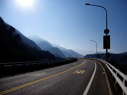
As I loped along the Highway 21, I kept looking for the legs to meet me somewhere over the next rise. The road seems relatively flat and the discouraging forward pace on the gradual incline is a real heart breaker. Only on the descent can you fully appreciate that the road is a constant 2%-4% grade.
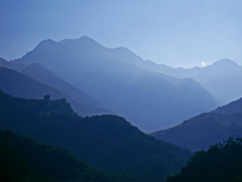
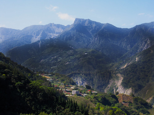
In the morning light the mountains appear to stack up all upon each other as the highway dips and curves in a slow-motion roller coaster ride around old landslides and water hazards.
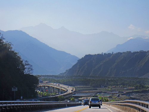
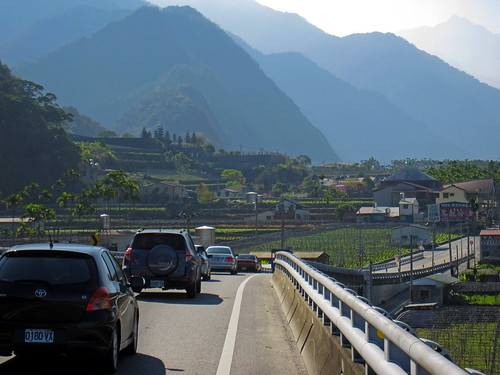
The narrow river valley passes through some small farming villages that seem keen on making more money from tourism than farming.
I hadn't taken the highway 21 in several years, so I couldn't remember how far I had to ride before the real climbing started.
it seemed the river valley just went on forever.
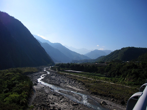
Finally, it seemed I had veered away from simply following the river and I braced for the serious climbing.
Oddly enough, once the steeper grades arrived I felt better and more comfortable climbing. I eased up the mountain at an even pace with a few stops to simply document the trip and not the occasional strategic leg-rest-photo-op.
On the map the road squiggled all over the hillsides like an anaconda sunning itself on a Taiwanese hillside. On paper it looks much more formidable than it really is. The confusing pile of roadway folded upon itself on the map was really a sensible grade that used each curve and bend to take some of the severity off the skyward ascent to 2600m. (8530ft.)
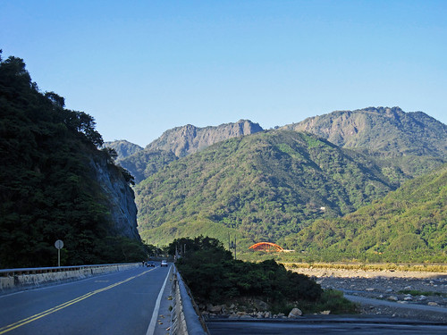
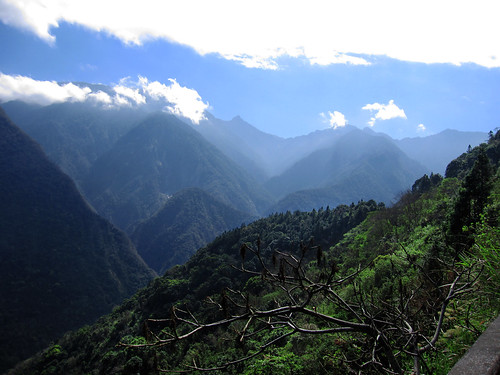
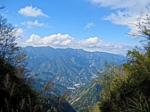
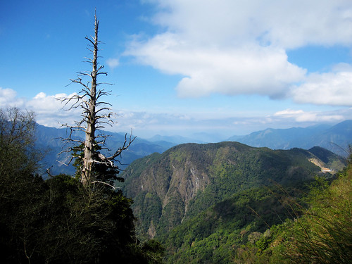
The scenery was spectacular and sheer cliff faces and towering mountains rise from the abyss below.
If Wuling is Taiwan's first cycling monument for its incredible height (3275m.) and short distance from sea level, Tatajia is Taiwan's second cycling monument. While the ride to Wuling throws much nastier ramps in front of a rider, its course through mountain farms, cedar forests and alpine meadows has a somewhat friendlier countenance than Tatajia. There is something very severe, stark and raw about Tatajia that is both frightening and compelling. It has a cold ruggedness about the landscape, and a glaring silence as well, that makes a lone rider skirting the cliff's edge feel totally exposed and unteathered to the roadway.
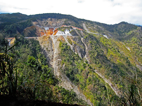
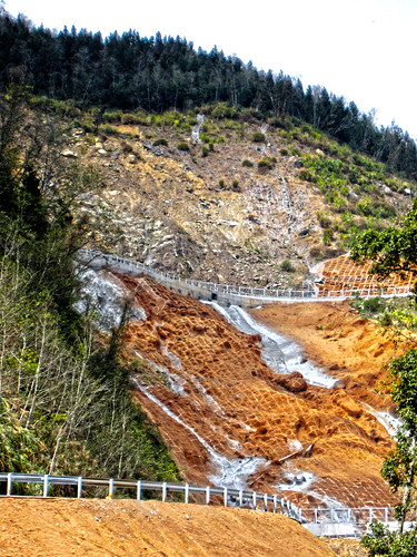
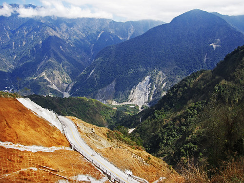
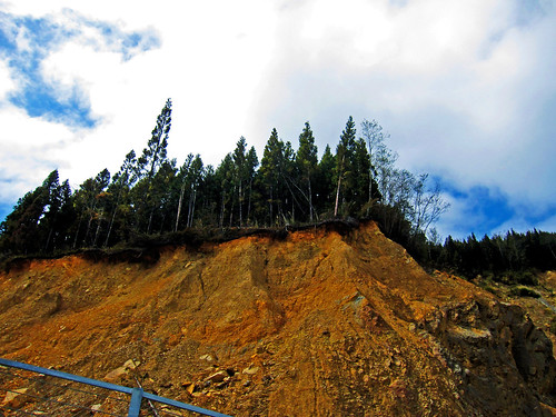
After a succession of tunnels a huge, ugly scar rips across the mountain like nature's own warning sign. The area is strewn with concrete, rubble, rebar and other debris.
As I made my approach the entire area was thick with the smell of burning brake oil as drivers overheat their brakes unsure and fearful of the scene of such obvious violence.
As a rider I instinctively knew that this was the main event. It had the terrifying look of battle and I brought the fight to each pitch and ramp.
The road looked as if someone had hastily flopped a wet ribbon across the brick-red clay and called it good.
With my adrenaline pumping from hugging the guardrail away from oncoming traffic, I realized I had made it past the most imposing stretch of my ride and I would soon be surrounded by the cool shadows of cedar boughs in the forest.
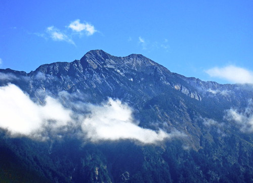
The air hand the crisp clearness of Winter. Off to my left I could see each crack and snarl in Jade Mountain, the highest mountain in East Asia (3952m./12966ft.)
It looked just like the picture on my bank book.
With the turn of a corner I was looking down the northern face of Alishan. I was becoming aware of the thin air and I worked harder to make progress. I was also becoming aware of a growl in my stomach. I had burned almost 4000 calories on the ascent and I was out of food. The extra food was gone. I had been hoping to find a tourist stop with a few vendors selling stuff I swore I'd never eat.
As I closed in on my goal of the God Trees, I was beginning to think more about food. The rule is to drink before you are thirsty and to eat before you are hungry. I was in caloric deficit and my body knew it. I did not want to bonk on Alishan.
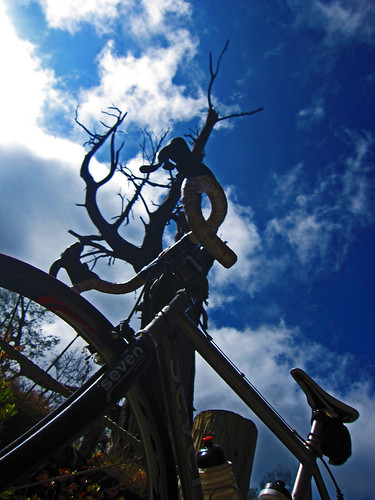
At last I turned a corner and found my trees. There were several tourists milling around taking pictures, but no food.
I took a rest for a few minutes and posed for some tourists who obviously couldn't see how little enthusiasm I had for pictures. With my late start I was still able to summit by 2:00pm, which was my plan to land me back at my car before 5:00pm.
My descent was incredibly fast. All the parts I had thought were dips or flat, were showing themselves to be pointing down hill. The only thing on my mind was to get whereI could grab some quick fuel for my legs.
At the bottom of the climb there was a 7-11. I stopped for a late lunch that looked like it was chosen by an 8yo. It was all food high in sugar and caffeine to give my legs something immediate to burn. I threw in a rice ball to digest, but it was mostly all junk. I had about 1000 calories in 10 minutes and was back on my way.
After about a half hour I was feeling much better with a new spring to my stroke. I launched up the remaining hills to Shuili and was back at the car early after logging 150k of riding.
I popped open a bottle of water and quenched my thirst before heading toward home.
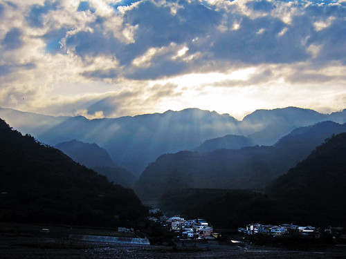
As soon as I left Shuili I was stuck in a three and a half hour traffic jam to the #3 Freeway. All the mountain roads feed like tributaries into Mingjian causing severe holiday traffic. After al that riding I was stuck without dinner until after 8:30pm.
The road up Tatajia is higher than the 149甲to Fenqihu, but it is also easier with easier gradients to climb. I had actually been contemplating returning on the 149甲, but my morning coffee was just a bit too long to give it a try.
There were too many tourists on the road on my way out, but it was doable. The scenery was the type of spectacular you get when riding Taiwan's Central Mountain Range. Lots of good stuff on this ride, just remember to bring enough food.