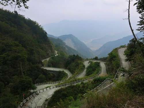
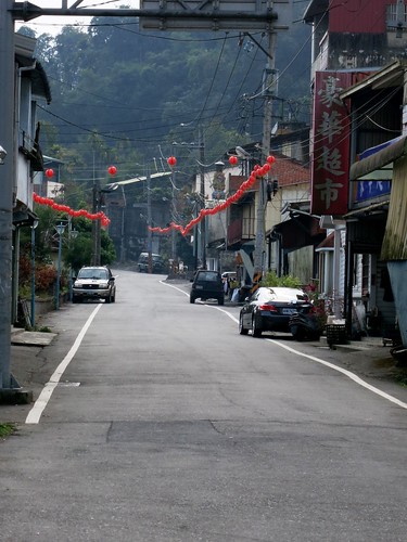
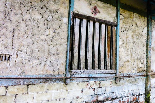
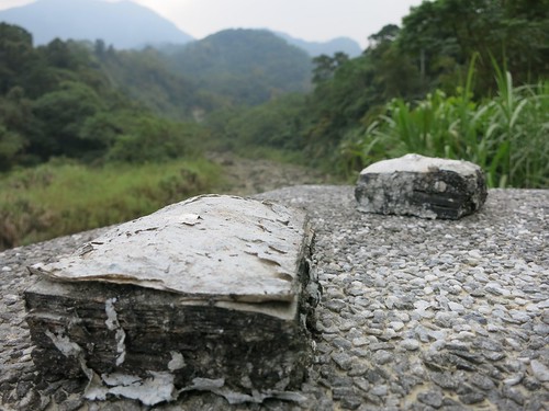
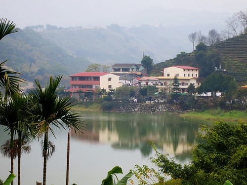
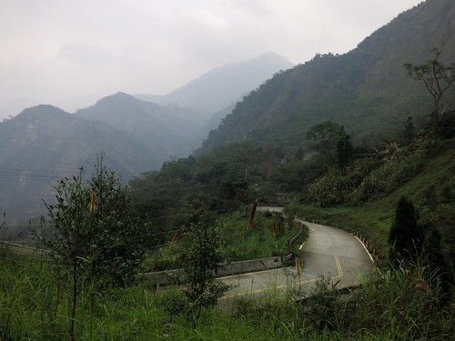
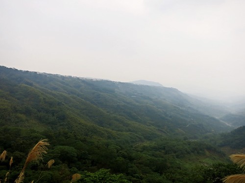
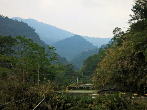
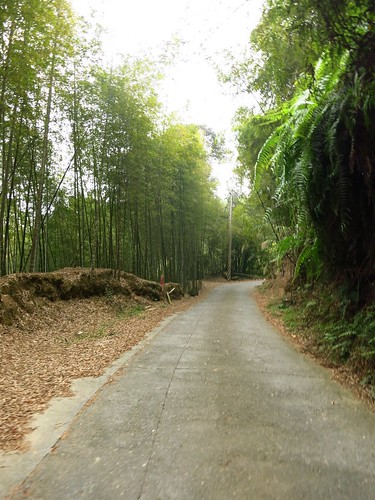
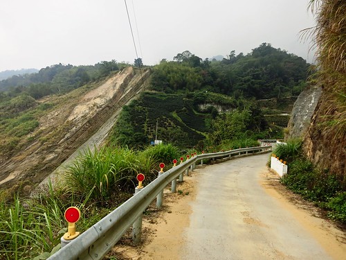
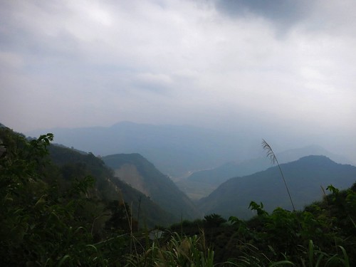
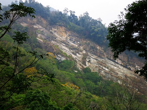
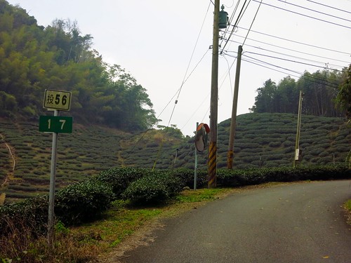
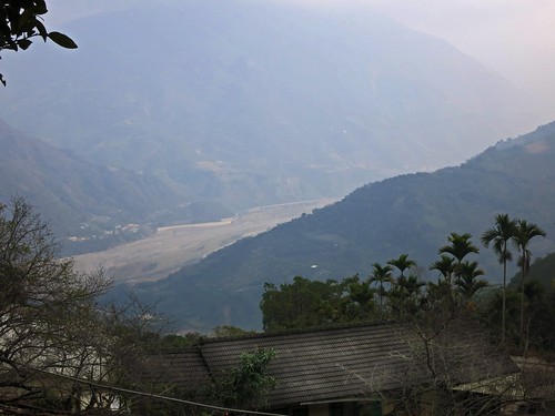
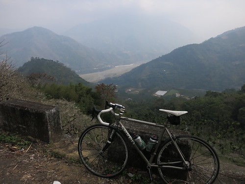
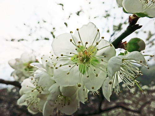
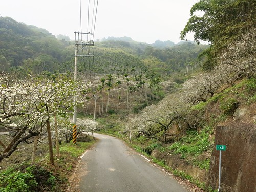
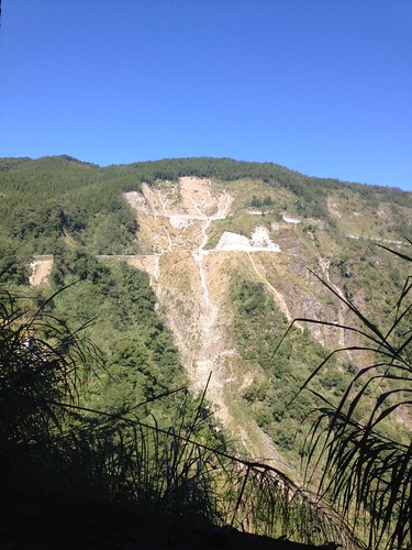
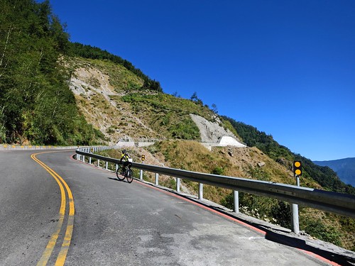
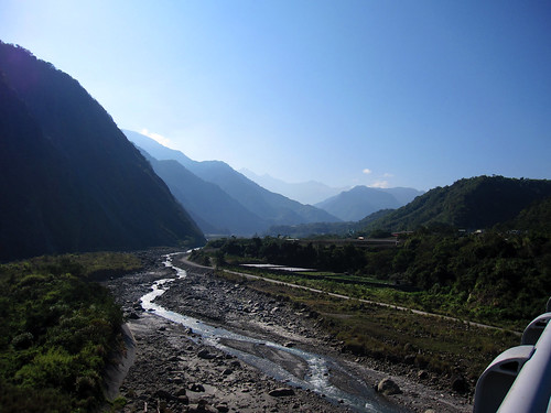
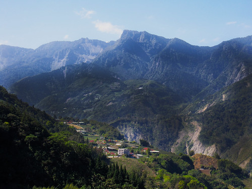
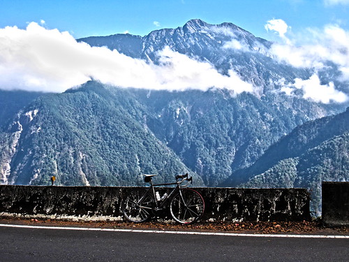
There are some roads that may not look like much on a map, but they are begging to be ridden. Several weeks ago I decided to climb the 頭49 to Sanlinxi and it gave me ample time to study some of the smaller roads in the hills around Lugu. There were several loose strings, a few promises... and then there was the 頭56. As soon as I realized what I was looking at, I knew I needed to make an attempt on it while the dry winter weather was still dry and wintery. This past Saturday I threw myself into the unknown and experienced the most significant new road (to me) in a very long time. I took off a bit later than I had hoped, and I slept on auto-pilot all the way to Mingjian, where I plodded my way along the Highway 16 to Jiji. At the 131 bridge, I started to wake up and take notice of my surroundings. I didn't want to miss my turn into the unknown. The 頭101 is the first deviation I made from my regular route, and I soon realised I had been on the same road several years earlier. For a Saturday on Lugu it was amazingly quiet. I may have encountered only one car on the entire stretch of road. The 頭101 is one of those foothill roads that clings to a sandy riverbank and meanders past bare clay walls where chunks of hillside have fallen away. I was soon on the 頭56 where I took the left along a strange trout pond. The whole area around Fonghu Shan is littered with tourist resorts and hostels for the weekend getaway. Tackiness stacked on top of tackiness on top of the faux-brow aesthetic. I was worried. A couple kilometres further toward a bird sanctuary, the touristville evaporates and the mood is suddenly silent. After a tricky right hand hook past the ticket gate of Birdland, it is as if the road enters a parallel universe of ultimate tranquility. It is like plunging a thousand feet below to the Land of the Lost. I was wide awake. The 頭56 whips and wends through the narrowest cliffs this side of Taroko. There is little room for anything else but the relatively broad width of a two lane highway. And that was the thing about it. It looked like an actual highway... except it was almost completely abandoned, save for a few red pepper farms and an earth god shrine. It is otherworldly. I missed the right hook and arrived at a dead end. The highway had quite literally died. It appears the road had formerly been a much busier highway, until an earthquake or some other calamity cleaved a chunk of rock the size of a small town from the side of the mountain. From this point on the broad two lane highway became a rough trod trail of chunky concrete that cut through jungle and bamboos. The climb was demanding, but doable and the jolt of adrenaline from the view helped make it all the easier. The climb was over as soon as it started and I was quickly cruising toward Xinyi Township. I kept getting peeks at the river valley below from gaps in the trees. The final descent rips right through the middle of a plum field with the white blossoms looking like fresh snowfall. I made an initial attempt at the 頭59, but the steady line of VW Transporter vans encouraged my hasty retreat. The 頭56 is an extremely significant road as it provides a corridor from the Highway 21 behind Alishan to Lugu. This is huge as it can connect Lugu and Sanlinxi to larger trips around Alishan without being an unnecessary diversion. Imagine planning a trip through the mountains of Taiwan and coming up the 頭49, 頭51-1 to Sanlinxi, then simply taking the 頭56 out to the Highway 21 before assailing Tatajia. The 頭56 is not a very long stretch and it isn't a monument of physical endurance, but it provides the vital link between some other excellent routes.
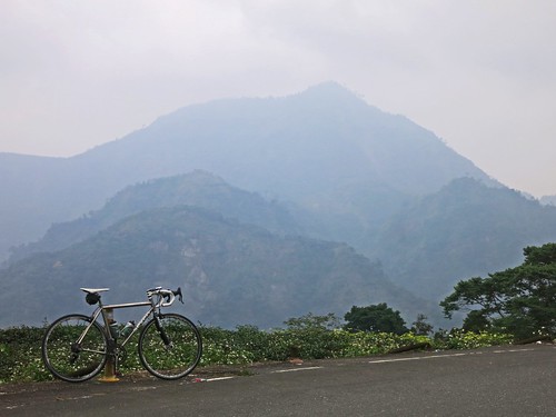
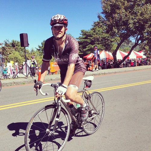
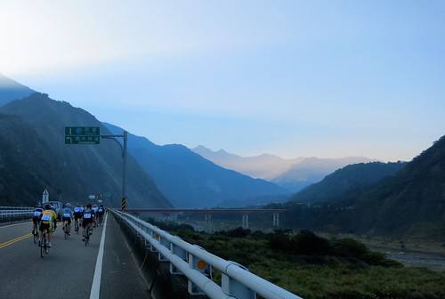
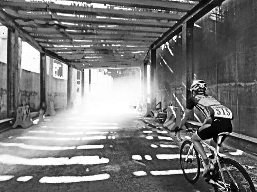
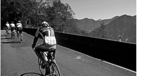
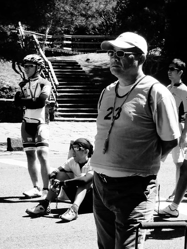
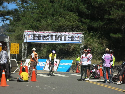
Even after having an embarrassingly disastrous day on Wuling just a few short weeks prior, I unflinchingly signed up for another of Taiwan's notorious hill climbs. This time I would be participating in the Tataka Hill Climb on the back side of Alishan. By 4:30am the riders had already started to fill up the sleepy streets of the small town of Shuili in Taiwan's Nantou County. There was a bit of a chill and everyone nervously clacked around on their cleats making unfunny jokes and taking in gels to break the nervousness. I couldn't decide if a jacket would be overkill or if I would be begging for a layer in a fog bank over Tataka. Having lowered my expectations, I was just happy to be doing a race I had never done before knowing that it might be the last Tataka Hill Climb as the county government would like to take over to funnel money to connected subcontractors. I was finally healthy enough to join T-Mosaic on another campaign. As we all eased out into the road, I was spinning a pretty good gear and found myself at the head of the group that was licking at the heels of the elite riders who had been given the preferential spot on the starting order. My legs started to burn after about 10min. but I was sure I would warm them up in a half-hour or so and I kept on moving with the pack, occasionally losing riders on every arc along the Highway 21. With my legs still failing to shake the burn, I eased up a little and let the group pass as I targeted another group that I thought might give me a chance to save some energy. My legs were still at full burn after two hours amid some magnificent climbs. I hadn't been passed by too many large groups and I hadn't seen my teammates anywhere, so I figured I was still in relatively good position for a decent time. The road wriggles itself all over the lower reaches of mountain before the first tunnels signal the end is nigh. Despite trying to claw up in a 39-27 combo, I still mashed my way past several riders on the lower sections. As I rounded a corner the full, deeply scarred face of the mountain was on full display, menacing riders from above. On the first of the horrible ramps I just bit down and stepped on the pedals until they turned. My legs were on fire. I pulled up next to another rider and offered some small talk to take the mind off the pain, but she wasn't amused. "Three more kilometers left", she said much to my relief. But as she slipped away into the shadows from the trees behind me, there was no sign that the finish was anywhere nearby. I found I was catching more and more riders with a steady churning of my crank. Finally after four kilometres the first sign showed up, "4km" it read. I forced myself to keep the legs in a white hot glow for four more kilometres. I kept climbing up a ladder of exhausted riders toward the finish. As the finish line came into view, I noticed two riders closing in on the finish and I made it my goal to pip them at the line for the cameras. I blitzed on past just before the line and gave an exaggerated fist pump as if I had actually won the whole thing.... but none of my antics or heroics were caught on camera. I had finished in a pedestrian 04:19:27. But to a guy who is still greatly out of shape, it was a much better day on the bike. I managed to be second on the team. The road was an absolute spectacle with clear views of Yushan and other vistas illuminated in the clear morning sunlight. Lots of fun.
This Lunar New Year was supposed to be about four weeks of regular riding to rebuild and return to lost form in the wake of the wonderful life-bomb called parenthood. I was poised to take advantage of a generous vacation package with little weekday rides and longer weekend riding. Four days into my vacation I got sick. It always happens. Just as the stars start to align themselves... WHAM!... back to square one. I spent about a week coughing my lungs clear enough to get back on the bike. Things still weren't coming together. I had to do a couple rehab rides after being sick to wake the legs up a bit more. I messed around in the hills over Taichung for some training, but nothing too far. I was actually becoming moody that my vacation was slipping away without a trophy or monument to show I had done something special with the only valuable commodity I had in any reserve-- time. The posts on my Facebook feed were already streaming in with painfully spectacular updates and pictures of a crisp, gorgeous sunny day on a ride to Wuling that I had to un-invite myself from. Mentally, I was pacing like a caged animal. I was brooding, moody and growling under my breath about my blood pressure being higher than what is normally my normal. I was just really pissed off. Then on the way home from dinner the idea popped into my head to drive the car to Shuili and then bike up to Tatajia on Alishan's eastern flank and then cap the summit before heading back to Shuili. The idea made perfect sense and I quickly and half-assedly made plans for a day of climbing. This spur of the moment rush of inspiration gave me no time to properly prepare for a long climb with the right intake of carbs and liquids. It was also pretty late, so I would be riding on less than ideal sleep. As the notion of the ride edged closer to reality I was feeling the buzz of excitement again. It felt good to be riding with a purpose.
There was no way I could wake up early enough for a pre-dawn launch, so I hoped for the best and hit the road by around 6:30am. I pulled into a sleepy Shuili and thought I would take in a tall cup of black coffee and a few more carbs at the 7-11. I guess I lingered a while as I hit the road closer to 9:00am with leaden legs that were having a difficult time turning over. Climbing is like that. When you start out it feels like there is no way you can ever complete the climb if the first 50 meters of the slightest incline feel like your legs are made of concrete plunging into mud on every pedal stroke. Sometimes it takes a sharp climb to wake the legs up and they're good for the rest of the ride.
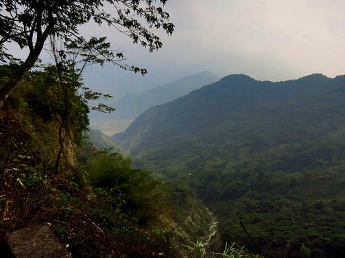
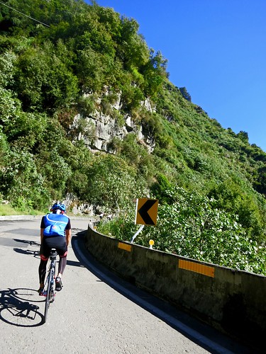
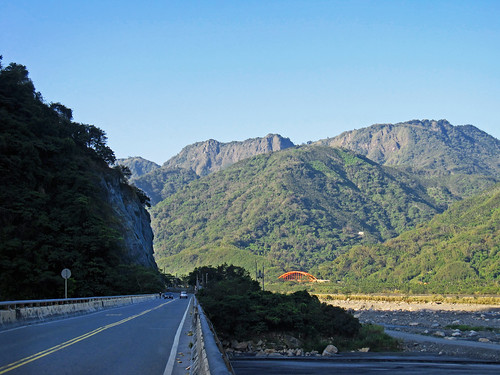
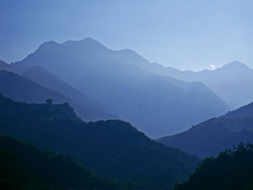
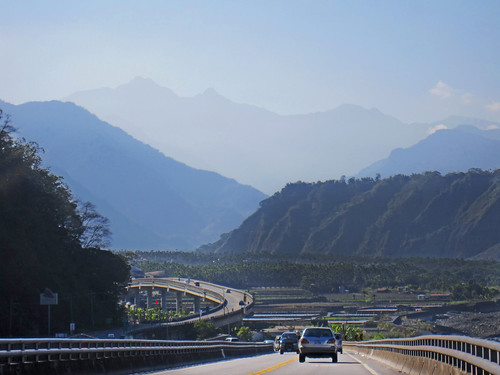
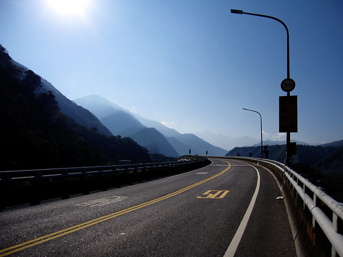
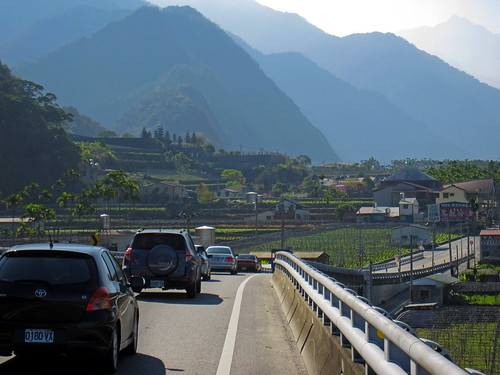
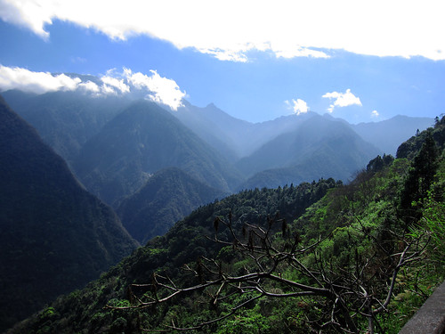
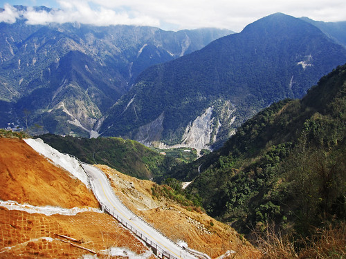
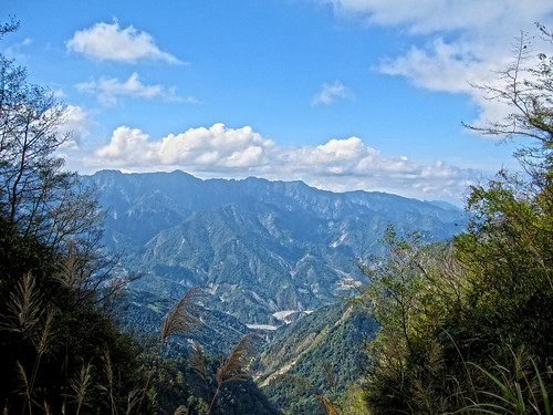
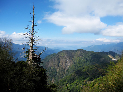
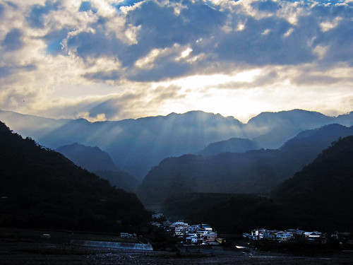
As I loped along the Highway 21, I kept looking for the legs to meet me somewhere over the next rise. The road seems relatively flat and the discouraging forward pace on the gradual incline is a real heart breaker. Only on the descent can you fully appreciate that the road is a constant 2%-4% grade. In the morning light the mountains appear to stack up all upon each other as the highway dips and curves in a slow-motion roller coaster ride around old landslides and water hazards. The narrow river valley passes through some small farming villages that seem keen on making more money from tourism than farming. I hadn't taken the highway 21 in several years, so I couldn't remember how far I had to ride before the real climbing started. it seemed the river valley just went on forever. Finally, it seemed I had veered away from simply following the river and I braced for the serious climbing. Oddly enough, once the steeper grades arrived I felt better and more comfortable climbing. I eased up the mountain at an even pace with a few stops to simply document the trip and not the occasional strategic leg-rest-photo-op. On the map the road squiggled all over the hillsides like an anaconda sunning itself on a Taiwanese hillside. On paper it looks much more formidable than it really is. The confusing pile of roadway folded upon itself on the map was really a sensible grade that used each curve and bend to take some of the severity off the skyward ascent to 2600m. (8530ft.) The scenery was spectacular and sheer cliff faces and towering mountains rise from the abyss below. If Wuling is Taiwan's first cycling monument for its incredible height (3275m.) and short distance from sea level, Tatajia is Taiwan's second cycling monument. While the ride to Wuling throws much nastier ramps in front of a rider, its course through mountain farms, cedar forests and alpine meadows has a somewhat friendlier countenance than Tatajia. There is something very severe, stark and raw about Tatajia that is both frightening and compelling. It has a cold ruggedness about the landscape, and a glaring silence as well, that makes a lone rider skirting the cliff's edge feel totally exposed and unteathered to the roadway.
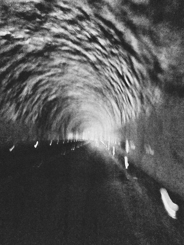
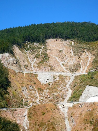
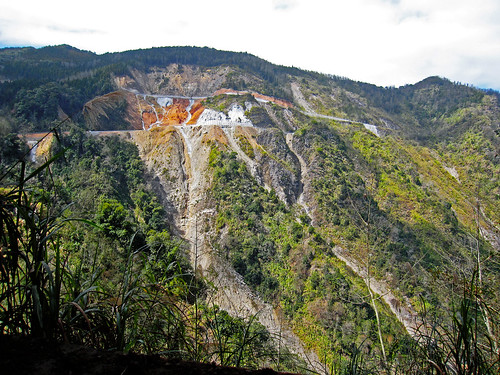
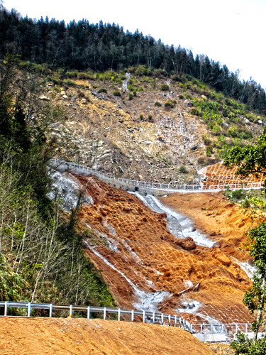
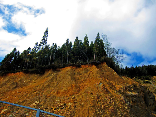
After a succession of tunnels a huge, ugly scar rips across the mountain like nature's own warning sign. The area is strewn with concrete, rubble, rebar and other debris. As I made my approach the entire area was thick with the smell of burning brake oil as drivers overheat their brakes unsure and fearful of the scene of such obvious violence. As a rider I instinctively knew that this was the main event. It had the terrifying look of battle and I brought the fight to each pitch and ramp.
The road looked as if someone had hastily flopped a wet ribbon across the brick-red clay and called it good.
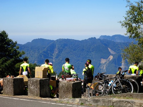
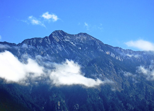
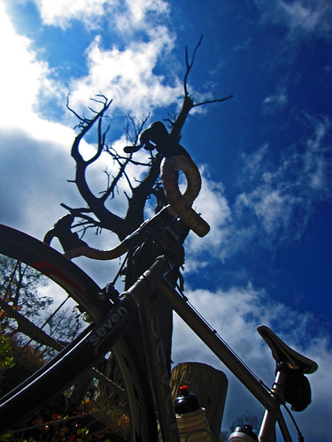
With my adrenaline pumping from hugging the guardrail away from oncoming traffic, I realized I had made it past the most imposing stretch of my ride and I would soon be surrounded by the cool shadows of cedar boughs in the forest. The air hand the crisp clearness of Winter. Off to my left I could see each crack and snarl in Jade Mountain, the highest mountain in East Asia (3952m./12966ft.) It looked just like the picture on my bank book. With the turn of a corner I was looking down the northern face of Alishan. I was becoming aware of the thin air and I worked harder to make progress. I was also becoming aware of a growl in my stomach. I had burned almost 4000 calories on the ascent and I was out of food. The extra food was gone. I had been hoping to find a tourist stop with a few vendors selling stuff I swore I'd never eat. As I closed in on my goal of the God Trees, I was beginning to think more about food. The rule is to drink before you are thirsty and to eat before you are hungry. I was in caloric deficit and my body knew it. I did not want to bonk on Alishan. At last I turned a corner and found my trees. There were several tourists milling around taking pictures, but no food.
I took a rest for a few minutes and posed for some tourists who obviously couldn't see how little enthusiasm I had for pictures. With my late start I was still able to summit by 2:00pm, which was my plan to land me back at my car before 5:00pm. My descent was incredibly fast. All the parts I had thought were dips or flat, were showing themselves to be pointing down hill. The only thing on my mind was to get whereI could grab some quick fuel for my legs. At the bottom of the climb there was a 7-11. I stopped for a late lunch that looked like it was chosen by an 8yo. It was all food high in sugar and caffeine to give my legs something immediate to burn. I threw in a rice ball to digest, but it was mostly all junk. I had about 1000 calories in 10 minutes and was back on my way. After about a half hour I was feeling much better with a new spring to my stroke. I launched up the remaining hills to Shuili and was back at the car early after logging 150k of riding. I popped open a bottle of water and quenched my thirst before heading toward home. As soon as I left Shuili I was stuck in a three and a half hour traffic jam to the #3 Freeway. All the mountain roads feed like tributaries into Mingjian causing severe holiday traffic. After al that riding I was stuck without dinner until after 8:30pm. The road up Tatajia is higher than the 149甲to Fenqihu, but it is also easier with easier gradients to climb. I had actually been contemplating returning on the 149甲, but my morning coffee was just a bit too long to give it a try. There were too many tourists on the road on my way out, but it was doable. The scenery was the type of spectacular you get when riding Taiwan's Central Mountain Range. Lots of good stuff on this ride, just remember to bring enough food.