body{background-attachment: fixed ! important; }
Showing posts with label Miaoli Route 119. Show all posts

Saturday, August 26, 2017

Miaoli 34-2 to 28

IMG_0833

It would seem 130km is a long way to travel to knock off a couple of roads. It is. And as I plugged my way northward on the Highway 13 through Sanyi, I wondered if I had made more trouble for myself than it was worth.

The thing is, whenever I travel on the HSR, I look out and see a bunch of cool looking roads and struggle to find them on the GPS before the internet dies in but another tunnel.

Just at the top of Miaoli are a series of HSR tunnels that flip through narrow valleys like an old zoetrope to flash an instant image of cycling of intrigue. I needed to find and ride those roads.

I have already attacked the ridge lines longitudinally, but there are still several roads that criss cross those hills I have yet to ride. I have since ticked several off my map. The Route 34-2 looked interesting along with the Route 28. I was on my way.

IMG_0794
I thought the Route 51-1 out of Houli would be a great start... and it was serene as usual.

IMG_0803

The 34-2 starts behind the Da Chien General Hospital (My map below is inaccurate at this point...sorry). You can pick it up just behind the parking area on the southern end of the hospital grounds.

IMG_0813
The descent is a lovely drop through fields and along twisty roads that pass beneath the HSR tracks.
When I got to the bottom I realized I had been to that spot several times on the Route 119. Personally, I prefer the Route 119 off the Highway 13 to get to this point.

IMG_0821

The Route 28 goes back up the hill above Miaoli City. It is one of those special littler roads that can feature as a satisfying leg to any adventure.

IMG_0847

The climb is never too much, but offers lovely views of the surrounding forest and out to the coast.

IMG_0859

Moreover, the roads are smooth, sweeping swaths of unused pavement. The experience was really pleasant as I huffed away over a river valley...thinking of incorporating this into more demanding rides.

IMG_0867

After a strange trip through an old railway town, I popped out behind a cemetery over Miaoli City. The view made Miaoli City look almost not repulsive.

The Route 28 is a keeper. The 34-2... meh!

IMG_0868

Monday, August 21, 2017

Back Roads: The CPC Industry Rd.

The Gas Road Strikes Again:

IMG_5843

I said I would never ride the "Gas Road" again. It had been an adventure and that was enough for me. I had successfully navigated the length of Taiwan's western ridge line from Xinchu to Taichung. Done. Curiosity had been sated.

Then I decided I had to show it off to a few people so they too could tick this little oddity off their maps of curiosity.

This time I was leading a small group of cyclists into one of those Bermuda Triangle spots on the mapping software where space aliens muck with the earth's electromagnetic filed and the GPS goes haywire. Fun!

IMG_5824

The first sight of a an effigy of a man hanging by his pretty white neck outside of Wenshui Village where the Highway 6 breaks from the Highway 3 to Gongguan looked to be a bad omen before we disappeared into the lost highway of Miaoli.

IMG_5827

The CPC Industry Road starts behind the CPC petroleum works near the site of Taiwan's earliest oil wells dating back to the late 19th century. The Japanese colonial government exploited Taiwan's limited oil reserves and built extensive extraction and processing facilities nearby. The site is still in use today with 28,000 barrels of crude pumped from a longitudinal vein along Taiwan's western coast.

IMG_5834

The climb is steady and steep in parts. There are few dwellings, though someone had build a large gated estate tucked behind the canopy of tall trees. It is eerily quiet as you ride past oil pumps high over Tongluo. The farming roads that cross the area are many and the hills are dotted with fruit farms.

IMG_5836

It is more than easy to take a wrong turn, and many of the surfaces are covered in dirt and debris.

IMG_5840

We emerged from the forest and into the misted farms above Dahu. The views are fantastic... when the clouds allow it.

IMG_5846

We eventually cruised down to meet the top of the Miaoli Route 60 that crosses the hill to join the Route 119 for home.

IMG_5850


Sunday, February 8, 2015

Gas Giants?: A Crude Ride Along Taiwan's Petroleum Parkway (中油專用道路)

Untitled

Cycling and fossil fuels seem to go together like oil and... er....

Anyway, for my first ride of the Lunar New Year holiday I decided to take my quest for the little road northward into Miaoli County for a chance to bisect the range of hills between the Highway 3 and the coast.

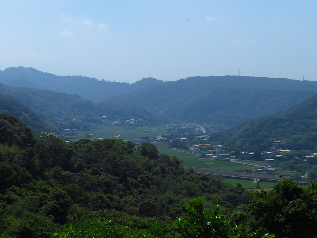
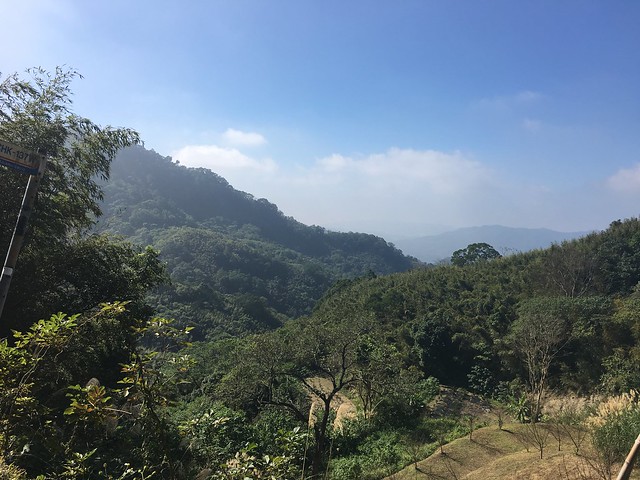
I have taken most of the major and minor routes that traverse these ridges-- the 130, the 60, 24, 26, and the others.... But I wanted to see if it was possible to climb to the top and follow the ridge line for the length of the hills. It looked like a project. Now that I have completed this ride and reported on it, I have saved any of you curious souls out there from having to unnecessarily tempt fate. If you have ever chugged up the Highway 3 between Jhuolan and Dahu, and wondered what kind of roads might be etched along those emerald peaks... look no further for I have come down the mountain with such knowledge.

Untitled

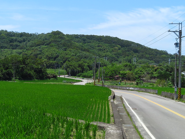
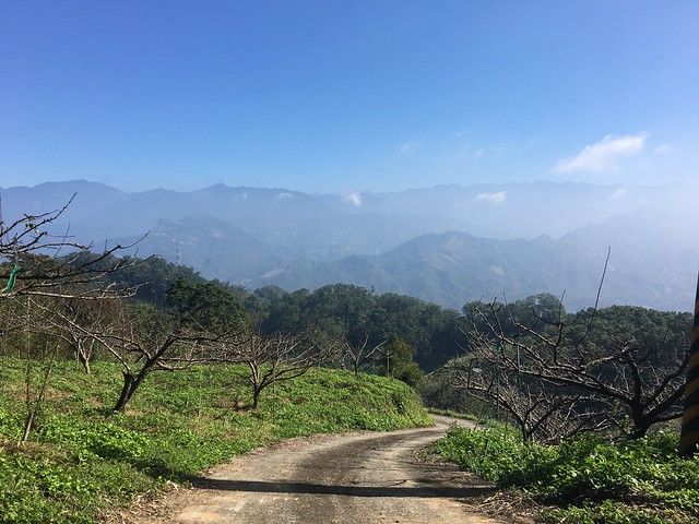
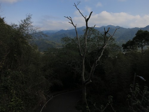
The day started out clear and promising, but Miaoli is the meteorological gateway to Taipei and can quickly transition from sunny and clear to gloomy, cold and wet.

Untitled

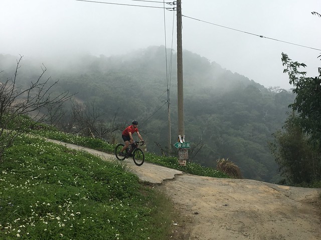
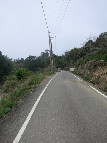
As I passed Dahu, I saw a road that might provide an early ascent to the ridge I was gunning for. I crossed the Bi'an Bridge and immediately launched myself upward along never-ending ramp of high percentage pain. The ramps never seemed to end.

Eventually I slumped over my handlebars at the top, only to find a monastery and a walking path in the direction I had hoped to take. Sometimes Google Maps is too optimistic and Apple Maps too pessimistic. It can be a coin toss as to whether a road is actually passable by road bike or merely a hiking trail.

Untitled

I had wasted a tremendous amount of glycogen on a gamble that didn't pay off and I did;t need any more dead ends complicating my ride. I was about to enter the unknown and I needed a little more assurance that I was not about to commit precious time and fuel on discovering Taiwan's best, lost dead end.

Untitled

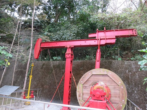
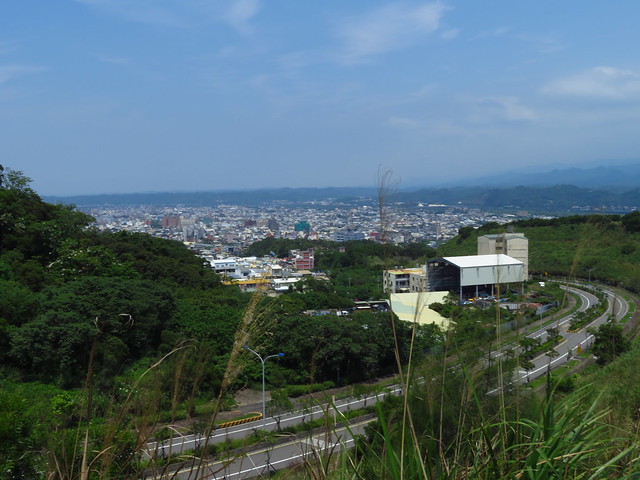
My hope was that the CPC Industrial Road (中油專用道路) would be my ticket to a hilltop tour of Miaoli County and a rendezvous with the Route 60 that would lead me out to a number of familiar roads that I could use to get home with the wind at my back.

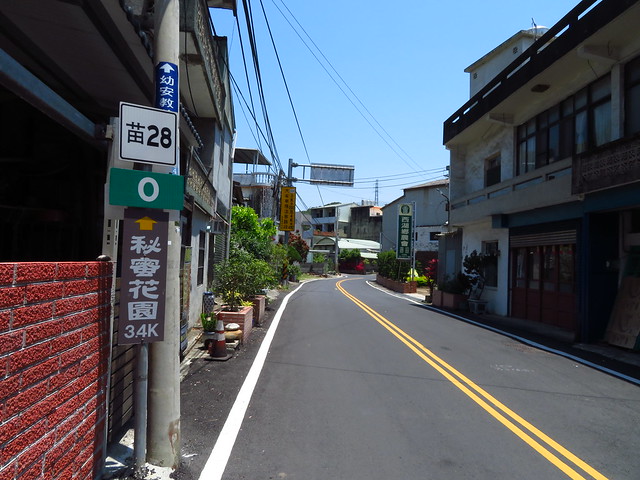
The CPC Industrial Road starts just off the Highway 6 past Dahu at the point where the 72 Expressway disappears into the mountain below Gong Guan.

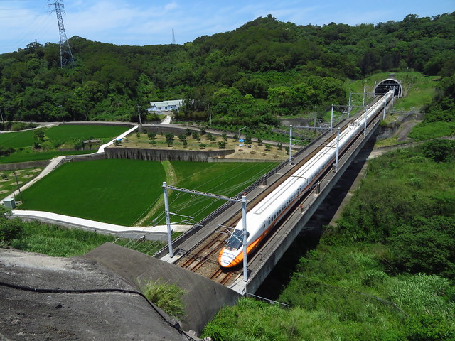
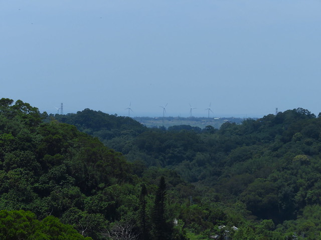
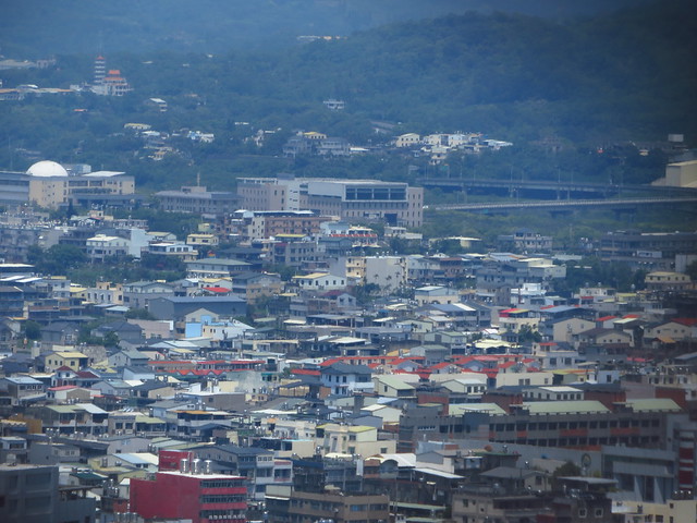
The road follows a terrestrial vein of liquid oil for the entire length of the hills between the Houlong and Da-an Rivers.

Oil was first discovered at the site in the 1860's and later exploited by the Japanese colonial administration. Today, Taiwan pumps 22,000 barrels of oil per day and refines its crude oil in four different refineries. This explains the refineries and petrochemical plants I have seen between Gong-guan and Toufen.

Untitled

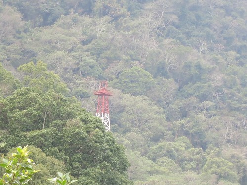
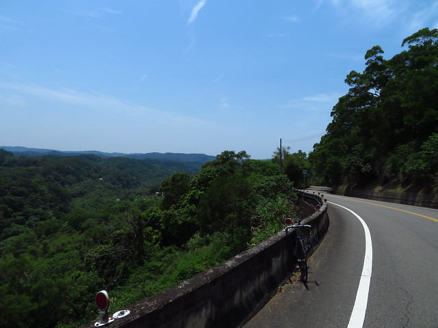
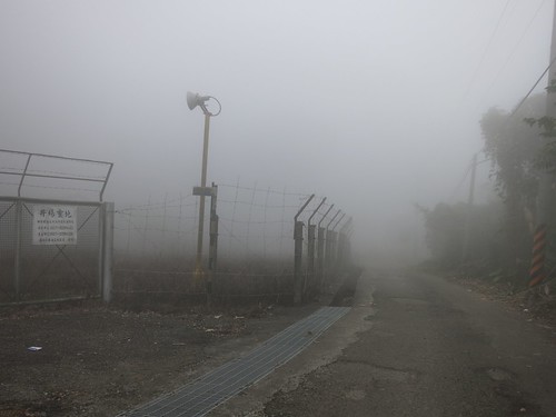
I knew I needed to be mindful of the road and there could be several service roads that lead to oil wells or other industrial sites. This kept me busy at my phone GPS and put a real drain on my battery life.

Untitled

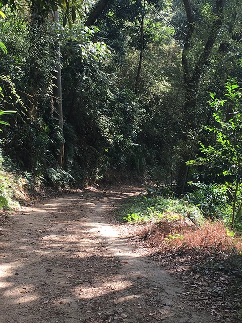
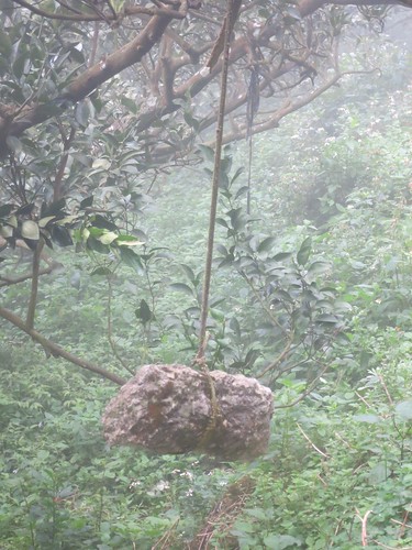
This really started out as a strange road. Aside from the hissing and steaming trees that had been rigged with misting nozzles to create an otherworldly effect similar to Tim the Enchanter, there were massive luxury properties with massive gates, a few imposing hostels, tiny farming shacks and several fenced off oil wells quietly littering the roadside.

I wondered if this road might be a total dud.

Untitled

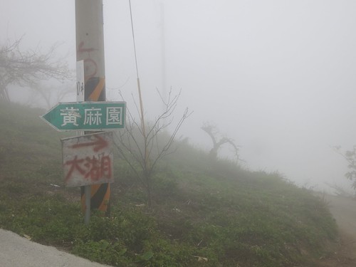
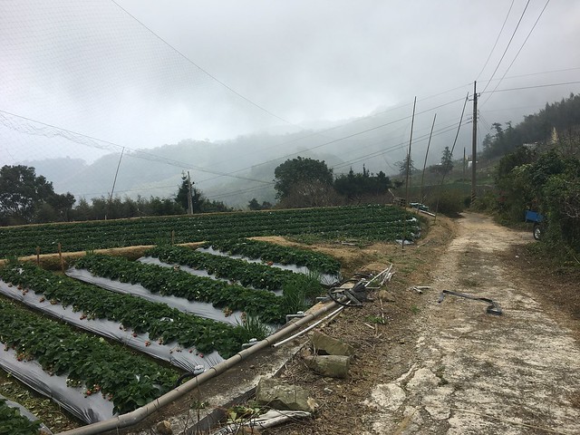
I nervously checked and rechecked my location and at the top of the hill I made the fateful decision to continue southward... just as a thick blanket of fog doused the area in a quiet, swirling chill.

Untitled

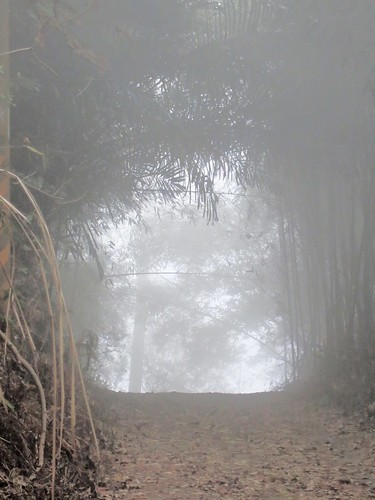
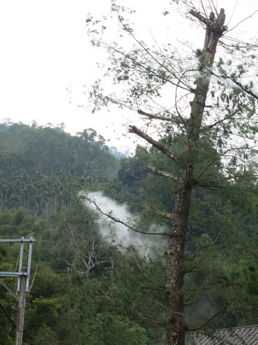
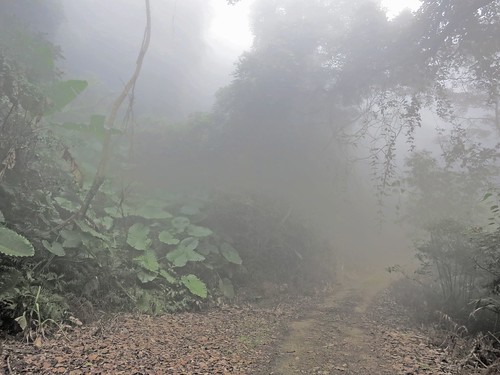
The feeling was otherworldly as I slowly rolled forward into the clouds. The landscape seemed to have closed in on me and the forest ebbed and floated in and out of focus. I tried to stay glued to the road and not mistake the void for a rare patch of smooth tarmac.

Untitled

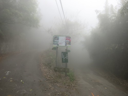
Visibility was between 6 to 10 meters at most times. At one point I almost ran straight into a line of four ghosts hovering in a patch of brightly lit fog-- ghosts that turned out to be men from a work crew who had lost their truck in the fog. I was surprised a d relieved to see other human beings up there in those conditions and they were all so silent. I finally broke the eerie quiet with a question about the road conditions and was informed that the roads ahead are technically passable to Tongluo, but not recommended.

I have heard that before and found beautiful roads and brushed off the comment as something from a person who underestimates the powers of a bicycle.

Untitled

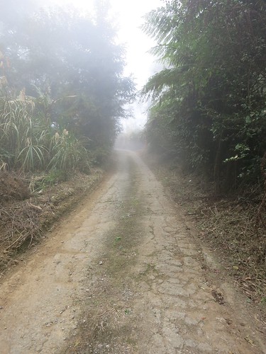
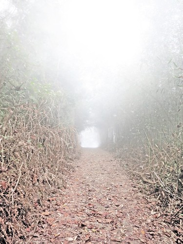
Even more fog sifted through the tangled canopy above as I disappeared into a chunky path of fragmented cement, mud and ground cover. I dismounted a few timed to walk down descents that were too steep and degraded to ride safely. The last thing I needed was a broken collarbone in an area like that.

Untitled

Somewhere in the tunnel of shadow and light, I surprised a true of macaques that woofed at me as I passed. It was enough to make me start whistling in the dark to ward off any more surprises. To make matters worse, my constant GPS checks had sucked my battery life down to 20% and I was still a long way from the familiar Route 60.

Untitled

As soon as I turned a corner and thought I was getting somewhere, I found I was on the wrong road. My GPS was unstable in the terrain and I had plotted the wrong road. That led to a hike  through some orchard or another and up another road. I soon found I my road was blocked by a pack of angry dogs. Being true to Taiwan, the most aggressive of the bunch were a chihuahua that wanted a piece of my heel, and an ill tempered corgi. I was in no position to turn back and had to face off with a pack of unruly hounds. The owner came out and simply ignored the situation as he got into his truck. 

I was soon dropping off down the back of the hill in zero visibility with the hope that any more dogs would not come charging through the orchards to rip me apart in an area so desolate nobody would hear my screams. 

I saw an arrow spray painted on the road and followed it in the direction of the bigger road. It led me deeper and deeper into an eroding creek bed that I hoped would not be the only way out. After sparingly checking my GPS, I concluded that I had missed the real road and had to hike back up into the fogged-in orchard if I was going to have any hope of escaping before dark. 

Untitled

I emerged from the forest and back out into orchard land. I could hear a chainsaw somewhere in the whiteout and felt some relief before a hellhound burst out of a hidden driveway to send me into a panicked sprint toward the unknown up ahead. 

Boom! I rolled across the path of the rest stop at the top on the Route 60. I knew where I was. Just as the fog became a wet fog, I was in familiar territory. 

I slid down the hill toward the Route 119 and the Route 49 until I was limping along through Sanyi on the Highway 13 toward home. 

I am sure there were some fantastic views from up there. The roads were horrendous and a complete safety hazard. A road bike does not belong up there at all... and it was a hell of an adventure... in retrospect. 

And now I know what is up on that hilltop. 


Untitled

Tuesday, September 23, 2014

Meditation in Miaoli: Miaoli Route 60(苗60)


Here is a little meditation through the foothills of Miaoli on the Route 60 between Dahu and Tongluo. 

I hadn't been on this road in a while and I thought I might have another look. I felt pretty good on the bike and the ride just turned into a meditation of sorts with my thoughts keeping me company as the machinery whirled away. 


The road looks like a dead end, but a smaller road juts out to the side and immediately introduced a nasty little hill that had me gasping for air. 


I made the climb and continued on the Miaoli Route 119 and 119-4 to Sanyi. It is a quiet little road, but I was in serious need of water and food. Just at the end of the Route 119-4 I went to a closet of a store and had the coldest bottle of water I have ever tasted. 

I raided the calories stored at a convenience store in Sanyi and then trudged on home. 


Just a simple day on the bike. 

Wednesday, September 26, 2012

Tour of Sanyi

IMG_9479

Sunday was a beautiful day to get out on a bike, so I did my best to wake up early and get out the door to enjoy the sunny weather. I had a few plans on the table, but settled on a ride through Sanyi on the southern edge of Miaoli County. 

IMG_9397

On my way out to Houli and the Highway 13, I couldn't help but stop to take a few pictured of my favorite example of Taiwan's rigid zoning regulations. 

IMG_9488

Pictured is the No. 74 Expressway that is being built to wrap around Taichung City. 

IMG_9489

This particular section has been built to thread the needle between the brand new Tzu Chi Hospital and its even newer annex. The expressway also passes within an eyelash of the Ivy Bilingual Academy dormitories. 

It is really something to see. 

IMG_9482

I plodded along through Houli, fighting the wind with every turn of the crank.

IMG_9402

The Highway 13 to Sanyi offers some great shots of various transportation schemes. Sometimes the built environment is just as wildly interesting as the natural environment. 

IMG_9409

The climb up to Sanyi was much easier than I remembered. It is good to pass through in the morning before the weekend tourists arrive to pick the place clean of "traditional Hakka" woodcarvings and handicrafts. 

IMG_9425

Sanyi is a town that saw most of its early growth as a train stop for forestry products. Now, the area is recognized for its woodcarving festival. Many Hakka people who came to Taiwan were skilled carvers and they moved to Miaoli as it resembled the geography of their former homes in the hills between Fujian and Guangdong in China. 

Many of Sanyi's Hakka families also come from families of ex-aborigines who simply became "Hakka" between the 18th and 20th Centuries. 

IMG_9427

The rail lines built by the Japanese colonial administration on Taiwan at the beginning of the 20th century really defined Sanyi as a town that mushroomed out, bisected by rails. 

IMG_9432

I passed numerous cyclists out to enjoy the weather. Groups large and small rolled along through Sanyi Township in a rolling demonstration of Taiwan's cycling culture. 

IMG_9435

IMG_9441

IMG_9446

I made my way through Tong-luo village on my way to hook up with the Highway 6; an easy viaduct to the Highway 3 for my return. 

IMG_9452

I guess it had been a while since I passed through the area and I misremembered the route back. In trying to cross another one of Taiwan's fabulous bridges, I had to sneak under the expressway along some creative solution for the area's non-motorized traffic. 

IMG_9455 IMG_9458

I think Taiwan is home to more interesting bridges per sq.km. than just about any other country on the planet. I am always amazed by what a construction budget and a willing architect can come up with. Someone should really do a photo essay on Taiwan's bridges. Seriously.

IMG_9472

I found myself on the Miaoli Route 119 heading back to Sanyi. I knew the road, but had never taken it to Sanyi. It was a drunken path of smooth tarmac in, on, over and around every bump and contour back to Sanyi. 

I could see the fields getting prepped for this winter's strawberry crop. 

I logged about 140km on the day and seemed to be doing well. Just not well enough. Too tired still. 

The day was really a nice time on the bike.  

IMG_9473
WebRep
currentVote
noRating
noWeight